A geospatial solution using a TOPSIS approach for prioritizing urban projects in Libya Article Swipe
 YOU?
·
· 2018
· Open Access
·
YOU?
·
· 2018
· Open Access
·
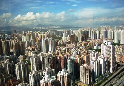
© 2018 Proceedings - 39th Asian Conference on Remote Sensing: Remote Sensing Enabling Prosperity, ACRS 2018 The world population is growing rapidly; consequently, urbanization has been in an increasing trend in many developing cities around the globe. This rapid growth in population and urbanization have also led to infrastructural development such as transportation systems, sewer, power utilities and many others. One major problem with rapid urbanization in developing/third-world countries is that developments in mega cities are hindered by ineffective planning before construction projects are initiated and mostly developments are random. Libya faces similar problems associated with rapid urbanization. To resolve this, an automating process via effective decision making tools is needed for development in Libyan cities. This study develops a geospatial solution based on GIS and TOPSIS for automating the process of selecting a city or a group of cities for development in Libya. To achieve this goal, fifteen GIS factors were prepared from various data sources including Landsat, MODIS, and ASTER. These factors are categorized into six groups of topography, land use and infrastructure, vegetation, demography, climate, and air quality. The suitability map produced based on the proposed methodology showed that the northern part of the study area, especially the areas surrounding Benghazi city and northern parts of Al Marj and Al Jabal al Akhdar cities, are most suitable. Support Vector Machine (SVM) model accurately classified 1178 samples which is equal to 78.5% of the total samples. The results produced Kappa statistic of 0.67 and average success rate of 0.861. Validation results revealed that the average prediction rate is 0.719. Based on the closeness coefficient statistics, Benghazi, Al Jabal al Akhdar, Al Marj, Darnah, Al Hizam Al Akhdar, and Al Qubbah cities are ranked in that order of suitability. The outputs of this study provide solution to subjective decision making in prioritizing cities for development.
Related Topics


- Type
- article
- Language
- en
- OA Status
- green
- Related Works
- 20
- OpenAlex ID
- https://openalex.org/W2936737091
Raw OpenAlex JSON
- OpenAlex ID
-
https://openalex.org/W2936737091Canonical identifier for this work in OpenAlex
- Title
-
A geospatial solution using a TOPSIS approach for prioritizing urban projects in LibyaWork title
- Type
-
articleOpenAlex work type
- Language
-
enPrimary language
- Publication year
-
2018Year of publication
- Publication date
-
2018-01-01Full publication date if available
- Authors
-
Maruwan S. A. B. Amazeeq, Bahareh Kalantar, Husam A. H. Al-Najjar, Mohammed Oludare Idrees, Biswajeet Pradhan, Shattri MansorList of authors in order
- Open access
-
YesWhether a free full text is available
- OA status
-
greenOpen access status per OpenAlex
- OA URL
-
https://hdl.handle.net/10453/134112Direct OA link when available
- Concepts
-
Urbanization, Geospatial analysis, Geography, TOPSIS, Population, Urban planning, Geographic information system, Environmental planning, Cartography, Environmental resource management, Civil engineering, Environmental science, Operations research, Economic growth, Engineering, Economics, Demography, SociologyTop concepts (fields/topics) attached by OpenAlex
- Cited by
-
0Total citation count in OpenAlex
- Related works (count)
-
20Other works algorithmically related by OpenAlex
Full payload
| id | https://openalex.org/W2936737091 |
|---|---|
| doi | |
| ids.mag | 2936737091 |
| ids.openalex | https://openalex.org/W2936737091 |
| fwci | 0.0 |
| type | article |
| title | A geospatial solution using a TOPSIS approach for prioritizing urban projects in Libya |
| biblio.issue | |
| biblio.volume | |
| biblio.last_page | |
| biblio.first_page | |
| topics[0].id | https://openalex.org/T13058 |
| topics[0].field.id | https://openalex.org/fields/23 |
| topics[0].field.display_name | Environmental Science |
| topics[0].score | 0.9800000190734863 |
| topics[0].domain.id | https://openalex.org/domains/3 |
| topics[0].domain.display_name | Physical Sciences |
| topics[0].subfield.id | https://openalex.org/subfields/2308 |
| topics[0].subfield.display_name | Management, Monitoring, Policy and Law |
| topics[0].display_name | Soil and Land Suitability Analysis |
| is_xpac | False |
| apc_list | |
| apc_paid | |
| concepts[0].id | https://openalex.org/C39853841 |
| concepts[0].level | 2 |
| concepts[0].score | 0.7704320549964905 |
| concepts[0].wikidata | https://www.wikidata.org/wiki/Q161078 |
| concepts[0].display_name | Urbanization |
| concepts[1].id | https://openalex.org/C9770341 |
| concepts[1].level | 2 |
| concepts[1].score | 0.6250425577163696 |
| concepts[1].wikidata | https://www.wikidata.org/wiki/Q1938983 |
| concepts[1].display_name | Geospatial analysis |
| concepts[2].id | https://openalex.org/C205649164 |
| concepts[2].level | 0 |
| concepts[2].score | 0.6134316921234131 |
| concepts[2].wikidata | https://www.wikidata.org/wiki/Q1071 |
| concepts[2].display_name | Geography |
| concepts[3].id | https://openalex.org/C51566761 |
| concepts[3].level | 2 |
| concepts[3].score | 0.5974473357200623 |
| concepts[3].wikidata | https://www.wikidata.org/wiki/Q1235853 |
| concepts[3].display_name | TOPSIS |
| concepts[4].id | https://openalex.org/C2908647359 |
| concepts[4].level | 2 |
| concepts[4].score | 0.5199200510978699 |
| concepts[4].wikidata | https://www.wikidata.org/wiki/Q2625603 |
| concepts[4].display_name | Population |
| concepts[5].id | https://openalex.org/C49545453 |
| concepts[5].level | 2 |
| concepts[5].score | 0.46644896268844604 |
| concepts[5].wikidata | https://www.wikidata.org/wiki/Q69883 |
| concepts[5].display_name | Urban planning |
| concepts[6].id | https://openalex.org/C41856607 |
| concepts[6].level | 2 |
| concepts[6].score | 0.4179016649723053 |
| concepts[6].wikidata | https://www.wikidata.org/wiki/Q483130 |
| concepts[6].display_name | Geographic information system |
| concepts[7].id | https://openalex.org/C91375879 |
| concepts[7].level | 1 |
| concepts[7].score | 0.4056466817855835 |
| concepts[7].wikidata | https://www.wikidata.org/wiki/Q15473274 |
| concepts[7].display_name | Environmental planning |
| concepts[8].id | https://openalex.org/C58640448 |
| concepts[8].level | 1 |
| concepts[8].score | 0.3459349274635315 |
| concepts[8].wikidata | https://www.wikidata.org/wiki/Q42515 |
| concepts[8].display_name | Cartography |
| concepts[9].id | https://openalex.org/C107826830 |
| concepts[9].level | 1 |
| concepts[9].score | 0.3403880000114441 |
| concepts[9].wikidata | https://www.wikidata.org/wiki/Q929380 |
| concepts[9].display_name | Environmental resource management |
| concepts[10].id | https://openalex.org/C147176958 |
| concepts[10].level | 1 |
| concepts[10].score | 0.2158432900905609 |
| concepts[10].wikidata | https://www.wikidata.org/wiki/Q77590 |
| concepts[10].display_name | Civil engineering |
| concepts[11].id | https://openalex.org/C39432304 |
| concepts[11].level | 0 |
| concepts[11].score | 0.19863983988761902 |
| concepts[11].wikidata | https://www.wikidata.org/wiki/Q188847 |
| concepts[11].display_name | Environmental science |
| concepts[12].id | https://openalex.org/C42475967 |
| concepts[12].level | 1 |
| concepts[12].score | 0.18453475832939148 |
| concepts[12].wikidata | https://www.wikidata.org/wiki/Q194292 |
| concepts[12].display_name | Operations research |
| concepts[13].id | https://openalex.org/C50522688 |
| concepts[13].level | 1 |
| concepts[13].score | 0.17038825154304504 |
| concepts[13].wikidata | https://www.wikidata.org/wiki/Q189833 |
| concepts[13].display_name | Economic growth |
| concepts[14].id | https://openalex.org/C127413603 |
| concepts[14].level | 0 |
| concepts[14].score | 0.14742961525917053 |
| concepts[14].wikidata | https://www.wikidata.org/wiki/Q11023 |
| concepts[14].display_name | Engineering |
| concepts[15].id | https://openalex.org/C162324750 |
| concepts[15].level | 0 |
| concepts[15].score | 0.0 |
| concepts[15].wikidata | https://www.wikidata.org/wiki/Q8134 |
| concepts[15].display_name | Economics |
| concepts[16].id | https://openalex.org/C149923435 |
| concepts[16].level | 1 |
| concepts[16].score | 0.0 |
| concepts[16].wikidata | https://www.wikidata.org/wiki/Q37732 |
| concepts[16].display_name | Demography |
| concepts[17].id | https://openalex.org/C144024400 |
| concepts[17].level | 0 |
| concepts[17].score | 0.0 |
| concepts[17].wikidata | https://www.wikidata.org/wiki/Q21201 |
| concepts[17].display_name | Sociology |
| keywords[0].id | https://openalex.org/keywords/urbanization |
| keywords[0].score | 0.7704320549964905 |
| keywords[0].display_name | Urbanization |
| keywords[1].id | https://openalex.org/keywords/geospatial-analysis |
| keywords[1].score | 0.6250425577163696 |
| keywords[1].display_name | Geospatial analysis |
| keywords[2].id | https://openalex.org/keywords/geography |
| keywords[2].score | 0.6134316921234131 |
| keywords[2].display_name | Geography |
| keywords[3].id | https://openalex.org/keywords/topsis |
| keywords[3].score | 0.5974473357200623 |
| keywords[3].display_name | TOPSIS |
| keywords[4].id | https://openalex.org/keywords/population |
| keywords[4].score | 0.5199200510978699 |
| keywords[4].display_name | Population |
| keywords[5].id | https://openalex.org/keywords/urban-planning |
| keywords[5].score | 0.46644896268844604 |
| keywords[5].display_name | Urban planning |
| keywords[6].id | https://openalex.org/keywords/geographic-information-system |
| keywords[6].score | 0.4179016649723053 |
| keywords[6].display_name | Geographic information system |
| keywords[7].id | https://openalex.org/keywords/environmental-planning |
| keywords[7].score | 0.4056466817855835 |
| keywords[7].display_name | Environmental planning |
| keywords[8].id | https://openalex.org/keywords/cartography |
| keywords[8].score | 0.3459349274635315 |
| keywords[8].display_name | Cartography |
| keywords[9].id | https://openalex.org/keywords/environmental-resource-management |
| keywords[9].score | 0.3403880000114441 |
| keywords[9].display_name | Environmental resource management |
| keywords[10].id | https://openalex.org/keywords/civil-engineering |
| keywords[10].score | 0.2158432900905609 |
| keywords[10].display_name | Civil engineering |
| keywords[11].id | https://openalex.org/keywords/environmental-science |
| keywords[11].score | 0.19863983988761902 |
| keywords[11].display_name | Environmental science |
| keywords[12].id | https://openalex.org/keywords/operations-research |
| keywords[12].score | 0.18453475832939148 |
| keywords[12].display_name | Operations research |
| keywords[13].id | https://openalex.org/keywords/economic-growth |
| keywords[13].score | 0.17038825154304504 |
| keywords[13].display_name | Economic growth |
| keywords[14].id | https://openalex.org/keywords/engineering |
| keywords[14].score | 0.14742961525917053 |
| keywords[14].display_name | Engineering |
| language | en |
| locations[0].id | pmh:oai:psasir.upm.edu.my:67014 |
| locations[0].is_oa | False |
| locations[0].source.id | https://openalex.org/S4377196260 |
| locations[0].source.issn | |
| locations[0].source.type | repository |
| locations[0].source.is_oa | False |
| locations[0].source.issn_l | |
| locations[0].source.is_core | False |
| locations[0].source.is_in_doaj | False |
| locations[0].source.display_name | Universiti Putra Malaysia Institutional Repository (Universiti Putra Malaysia) |
| locations[0].source.host_organization | https://openalex.org/I130343225 |
| locations[0].source.host_organization_name | Universiti Putra Malaysia |
| locations[0].source.host_organization_lineage | https://openalex.org/I130343225 |
| locations[0].license | |
| locations[0].pdf_url | |
| locations[0].version | acceptedVersion |
| locations[0].raw_type | Conference or Workshop Item |
| locations[0].license_id | |
| locations[0].is_accepted | True |
| locations[0].is_published | False |
| locations[0].raw_source_name | |
| locations[0].landing_page_url | |
| locations[1].id | pmh:oai:opus.lib.uts.edu.au:10453/134112 |
| locations[1].is_oa | True |
| locations[1].source.id | https://openalex.org/S4306401629 |
| locations[1].source.issn | |
| locations[1].source.type | repository |
| locations[1].source.is_oa | False |
| locations[1].source.issn_l | |
| locations[1].source.is_core | False |
| locations[1].source.is_in_doaj | False |
| locations[1].source.display_name | Open Publications Of UTS Scholars (University of Technology Sydney) |
| locations[1].source.host_organization | https://openalex.org/I114017466 |
| locations[1].source.host_organization_name | University of Technology Sydney |
| locations[1].source.host_organization_lineage | https://openalex.org/I114017466 |
| locations[1].license | other-oa |
| locations[1].pdf_url | http://hdl.handle.net/10453/134112 |
| locations[1].version | submittedVersion |
| locations[1].raw_type | Conference Proceeding |
| locations[1].license_id | https://openalex.org/licenses/other-oa |
| locations[1].is_accepted | False |
| locations[1].is_published | False |
| locations[1].raw_source_name | |
| locations[1].landing_page_url | http://hdl.handle.net/10453/134112 |
| locations[2].id | mag:2936737091 |
| locations[2].is_oa | False |
| locations[2].source | |
| locations[2].license | |
| locations[2].pdf_url | |
| locations[2].version | |
| locations[2].raw_type | |
| locations[2].license_id | |
| locations[2].is_accepted | False |
| locations[2].is_published | |
| locations[2].raw_source_name | |
| locations[2].landing_page_url | https://opus.lib.uts.edu.au/bitstream/10453/134112/1/Pages%20from%20ACRS%20Proceeedings%202018%20Vol.%201%20%282%29-4.pdf |
| authorships[0].author.id | https://openalex.org/A5039764966 |
| authorships[0].author.orcid | |
| authorships[0].author.display_name | Maruwan S. A. B. Amazeeq |
| authorships[0].author_position | first |
| authorships[0].raw_author_name | Maruwan S. A. B. Amazeeq |
| authorships[0].is_corresponding | False |
| authorships[1].author.id | https://openalex.org/A5055002169 |
| authorships[1].author.orcid | https://orcid.org/0000-0002-2822-3463 |
| authorships[1].author.display_name | Bahareh Kalantar |
| authorships[1].author_position | middle |
| authorships[1].raw_author_name | Bahareh Kalantar |
| authorships[1].is_corresponding | False |
| authorships[2].author.id | https://openalex.org/A5012816509 |
| authorships[2].author.orcid | https://orcid.org/0000-0001-9493-5517 |
| authorships[2].author.display_name | Husam A. H. Al-Najjar |
| authorships[2].author_position | middle |
| authorships[2].raw_author_name | Husam Abdulrasool H. Al-Najjar |
| authorships[2].is_corresponding | False |
| authorships[3].author.id | https://openalex.org/A5016528918 |
| authorships[3].author.orcid | https://orcid.org/0000-0002-0387-9888 |
| authorships[3].author.display_name | Mohammed Oludare Idrees |
| authorships[3].author_position | middle |
| authorships[3].raw_author_name | Mohammed Oludare Idrees |
| authorships[3].is_corresponding | False |
| authorships[4].author.id | https://openalex.org/A5059040421 |
| authorships[4].author.orcid | https://orcid.org/0000-0001-9863-2054 |
| authorships[4].author.display_name | Biswajeet Pradhan |
| authorships[4].author_position | middle |
| authorships[4].raw_author_name | Biswajeet Pradhan |
| authorships[4].is_corresponding | False |
| authorships[5].author.id | https://openalex.org/A5062622036 |
| authorships[5].author.orcid | https://orcid.org/0000-0001-5485-3517 |
| authorships[5].author.display_name | Shattri Mansor |
| authorships[5].author_position | last |
| authorships[5].raw_author_name | Shattri Mansor |
| authorships[5].is_corresponding | False |
| has_content.pdf | True |
| has_content.grobid_xml | True |
| is_paratext | False |
| open_access.is_oa | True |
| open_access.oa_url | http://hdl.handle.net/10453/134112 |
| open_access.oa_status | green |
| open_access.any_repository_has_fulltext | False |
| created_date | 2025-10-10T00:00:00 |
| display_name | A geospatial solution using a TOPSIS approach for prioritizing urban projects in Libya |
| has_fulltext | False |
| is_retracted | False |
| updated_date | 2025-11-06T04:12:42.849631 |
| primary_topic.id | https://openalex.org/T13058 |
| primary_topic.field.id | https://openalex.org/fields/23 |
| primary_topic.field.display_name | Environmental Science |
| primary_topic.score | 0.9800000190734863 |
| primary_topic.domain.id | https://openalex.org/domains/3 |
| primary_topic.domain.display_name | Physical Sciences |
| primary_topic.subfield.id | https://openalex.org/subfields/2308 |
| primary_topic.subfield.display_name | Management, Monitoring, Policy and Law |
| primary_topic.display_name | Soil and Land Suitability Analysis |
| related_works | https://openalex.org/W3088513064, https://openalex.org/W2051811275, https://openalex.org/W3198087584, https://openalex.org/W2017664994, https://openalex.org/W2156640059, https://openalex.org/W2134930949, https://openalex.org/W2227247710, https://openalex.org/W2589064507, https://openalex.org/W2794603472, https://openalex.org/W2756056387, https://openalex.org/W3162805317, https://openalex.org/W2973333612, https://openalex.org/W2946077403, https://openalex.org/W571987550, https://openalex.org/W2807658480, https://openalex.org/W3195073613, https://openalex.org/W3187354876, https://openalex.org/W3186788955, https://openalex.org/W2145481591, https://openalex.org/W2362789347 |
| cited_by_count | 0 |
| locations_count | 3 |
| best_oa_location.id | pmh:oai:opus.lib.uts.edu.au:10453/134112 |
| best_oa_location.is_oa | True |
| best_oa_location.source.id | https://openalex.org/S4306401629 |
| best_oa_location.source.issn | |
| best_oa_location.source.type | repository |
| best_oa_location.source.is_oa | False |
| best_oa_location.source.issn_l | |
| best_oa_location.source.is_core | False |
| best_oa_location.source.is_in_doaj | False |
| best_oa_location.source.display_name | Open Publications Of UTS Scholars (University of Technology Sydney) |
| best_oa_location.source.host_organization | https://openalex.org/I114017466 |
| best_oa_location.source.host_organization_name | University of Technology Sydney |
| best_oa_location.source.host_organization_lineage | https://openalex.org/I114017466 |
| best_oa_location.license | other-oa |
| best_oa_location.pdf_url | http://hdl.handle.net/10453/134112 |
| best_oa_location.version | submittedVersion |
| best_oa_location.raw_type | Conference Proceeding |
| best_oa_location.license_id | https://openalex.org/licenses/other-oa |
| best_oa_location.is_accepted | False |
| best_oa_location.is_published | False |
| best_oa_location.raw_source_name | |
| best_oa_location.landing_page_url | http://hdl.handle.net/10453/134112 |
| primary_location.id | pmh:oai:psasir.upm.edu.my:67014 |
| primary_location.is_oa | False |
| primary_location.source.id | https://openalex.org/S4377196260 |
| primary_location.source.issn | |
| primary_location.source.type | repository |
| primary_location.source.is_oa | False |
| primary_location.source.issn_l | |
| primary_location.source.is_core | False |
| primary_location.source.is_in_doaj | False |
| primary_location.source.display_name | Universiti Putra Malaysia Institutional Repository (Universiti Putra Malaysia) |
| primary_location.source.host_organization | https://openalex.org/I130343225 |
| primary_location.source.host_organization_name | Universiti Putra Malaysia |
| primary_location.source.host_organization_lineage | https://openalex.org/I130343225 |
| primary_location.license | |
| primary_location.pdf_url | |
| primary_location.version | acceptedVersion |
| primary_location.raw_type | Conference or Workshop Item |
| primary_location.license_id | |
| primary_location.is_accepted | True |
| primary_location.is_published | False |
| primary_location.raw_source_name | |
| primary_location.landing_page_url | |
| publication_date | 2018-01-01 |
| publication_year | 2018 |
| referenced_works_count | 0 |
| abstract_inverted_index.- | 3 |
| abstract_inverted_index.a | 119, 133, 136 |
| abstract_inverted_index.Al | 209, 212, 268, 272, 275, 277, 280 |
| abstract_inverted_index.To | 98, 144 |
| abstract_inverted_index.al | 214, 270 |
| abstract_inverted_index.an | 27, 101 |
| abstract_inverted_index.as | 51 |
| abstract_inverted_index.by | 77 |
| abstract_inverted_index.in | 26, 30, 40, 66, 72, 113, 142, 285, 301 |
| abstract_inverted_index.is | 19, 69, 109, 230, 259 |
| abstract_inverted_index.of | 131, 138, 169, 195, 208, 234, 243, 249, 288, 292 |
| abstract_inverted_index.on | 7, 123, 186, 262 |
| abstract_inverted_index.or | 135 |
| abstract_inverted_index.to | 47, 232, 297 |
| abstract_inverted_index.© | 0 |
| abstract_inverted_index.GIS | 124, 149 |
| abstract_inverted_index.One | 60 |
| abstract_inverted_index.The | 16, 181, 238, 290 |
| abstract_inverted_index.air | 179 |
| abstract_inverted_index.and | 42, 57, 85, 125, 160, 173, 178, 205, 211, 245, 279 |
| abstract_inverted_index.are | 75, 83, 88, 164, 217, 283 |
| abstract_inverted_index.for | 111, 127, 140, 304 |
| abstract_inverted_index.has | 24 |
| abstract_inverted_index.led | 46 |
| abstract_inverted_index.map | 183 |
| abstract_inverted_index.six | 167 |
| abstract_inverted_index.the | 35, 129, 187, 192, 196, 200, 235, 255, 263 |
| abstract_inverted_index.use | 172 |
| abstract_inverted_index.via | 104 |
| abstract_inverted_index.0.67 | 244 |
| abstract_inverted_index.1178 | 227 |
| abstract_inverted_index.2018 | 1, 15 |
| abstract_inverted_index.39th | 4 |
| abstract_inverted_index.ACRS | 14 |
| abstract_inverted_index.Marj | 210 |
| abstract_inverted_index.This | 37, 116 |
| abstract_inverted_index.also | 45 |
| abstract_inverted_index.been | 25 |
| abstract_inverted_index.city | 134, 204 |
| abstract_inverted_index.data | 155 |
| abstract_inverted_index.from | 153 |
| abstract_inverted_index.have | 44 |
| abstract_inverted_index.into | 166 |
| abstract_inverted_index.land | 171 |
| abstract_inverted_index.many | 31, 58 |
| abstract_inverted_index.mega | 73 |
| abstract_inverted_index.most | 218 |
| abstract_inverted_index.part | 194 |
| abstract_inverted_index.rate | 248, 258 |
| abstract_inverted_index.such | 50 |
| abstract_inverted_index.that | 70, 191, 254, 286 |
| abstract_inverted_index.this | 146, 293 |
| abstract_inverted_index.were | 151 |
| abstract_inverted_index.with | 63, 95 |
| abstract_inverted_index.(SVM) | 223 |
| abstract_inverted_index.78.5% | 233 |
| abstract_inverted_index.Asian | 5 |
| abstract_inverted_index.Based | 261 |
| abstract_inverted_index.Hizam | 276 |
| abstract_inverted_index.Jabal | 213, 269 |
| abstract_inverted_index.Kappa | 241 |
| abstract_inverted_index.Libya | 90 |
| abstract_inverted_index.Marj, | 273 |
| abstract_inverted_index.These | 162 |
| abstract_inverted_index.area, | 198 |
| abstract_inverted_index.areas | 201 |
| abstract_inverted_index.based | 122, 185 |
| abstract_inverted_index.equal | 231 |
| abstract_inverted_index.faces | 91 |
| abstract_inverted_index.goal, | 147 |
| abstract_inverted_index.group | 137 |
| abstract_inverted_index.major | 61 |
| abstract_inverted_index.model | 224 |
| abstract_inverted_index.order | 287 |
| abstract_inverted_index.parts | 207 |
| abstract_inverted_index.power | 55 |
| abstract_inverted_index.rapid | 38, 64, 96 |
| abstract_inverted_index.study | 117, 197, 294 |
| abstract_inverted_index.this, | 100 |
| abstract_inverted_index.tools | 108 |
| abstract_inverted_index.total | 236 |
| abstract_inverted_index.trend | 29 |
| abstract_inverted_index.which | 229 |
| abstract_inverted_index.world | 17 |
| abstract_inverted_index.0.719. | 260 |
| abstract_inverted_index.0.861. | 250 |
| abstract_inverted_index.ASTER. | 161 |
| abstract_inverted_index.Akhdar | 215 |
| abstract_inverted_index.Libya. | 143 |
| abstract_inverted_index.Libyan | 114 |
| abstract_inverted_index.MODIS, | 159 |
| abstract_inverted_index.Qubbah | 281 |
| abstract_inverted_index.Remote | 8, 10 |
| abstract_inverted_index.TOPSIS | 126 |
| abstract_inverted_index.Vector | 221 |
| abstract_inverted_index.around | 34 |
| abstract_inverted_index.before | 80 |
| abstract_inverted_index.cities | 33, 74, 139, 282, 303 |
| abstract_inverted_index.globe. | 36 |
| abstract_inverted_index.groups | 168 |
| abstract_inverted_index.growth | 39 |
| abstract_inverted_index.making | 107, 300 |
| abstract_inverted_index.mostly | 86 |
| abstract_inverted_index.needed | 110 |
| abstract_inverted_index.ranked | 284 |
| abstract_inverted_index.sewer, | 54 |
| abstract_inverted_index.showed | 190 |
| abstract_inverted_index.Akhdar, | 271, 278 |
| abstract_inverted_index.Darnah, | 274 |
| abstract_inverted_index.Machine | 222 |
| abstract_inverted_index.Sensing | 11 |
| abstract_inverted_index.Support | 220 |
| abstract_inverted_index.achieve | 145 |
| abstract_inverted_index.average | 246, 256 |
| abstract_inverted_index.cities, | 216 |
| abstract_inverted_index.cities. | 115 |
| abstract_inverted_index.factors | 150, 163 |
| abstract_inverted_index.fifteen | 148 |
| abstract_inverted_index.growing | 20 |
| abstract_inverted_index.others. | 59 |
| abstract_inverted_index.outputs | 291 |
| abstract_inverted_index.problem | 62 |
| abstract_inverted_index.process | 103, 130 |
| abstract_inverted_index.provide | 295 |
| abstract_inverted_index.random. | 89 |
| abstract_inverted_index.resolve | 99 |
| abstract_inverted_index.results | 239, 252 |
| abstract_inverted_index.samples | 228 |
| abstract_inverted_index.similar | 92 |
| abstract_inverted_index.sources | 156 |
| abstract_inverted_index.success | 247 |
| abstract_inverted_index.various | 154 |
| abstract_inverted_index.Benghazi | 203 |
| abstract_inverted_index.Enabling | 12 |
| abstract_inverted_index.Landsat, | 158 |
| abstract_inverted_index.Sensing: | 9 |
| abstract_inverted_index.climate, | 177 |
| abstract_inverted_index.decision | 106, 299 |
| abstract_inverted_index.develops | 118 |
| abstract_inverted_index.hindered | 76 |
| abstract_inverted_index.northern | 193, 206 |
| abstract_inverted_index.planning | 79 |
| abstract_inverted_index.prepared | 152 |
| abstract_inverted_index.problems | 93 |
| abstract_inverted_index.produced | 184, 240 |
| abstract_inverted_index.projects | 82 |
| abstract_inverted_index.proposed | 188 |
| abstract_inverted_index.quality. | 180 |
| abstract_inverted_index.rapidly; | 21 |
| abstract_inverted_index.revealed | 253 |
| abstract_inverted_index.samples. | 237 |
| abstract_inverted_index.solution | 121, 296 |
| abstract_inverted_index.systems, | 53 |
| abstract_inverted_index.Benghazi, | 267 |
| abstract_inverted_index.closeness | 264 |
| abstract_inverted_index.countries | 68 |
| abstract_inverted_index.effective | 105 |
| abstract_inverted_index.including | 157 |
| abstract_inverted_index.initiated | 84 |
| abstract_inverted_index.selecting | 132 |
| abstract_inverted_index.statistic | 242 |
| abstract_inverted_index.suitable. | 219 |
| abstract_inverted_index.utilities | 56 |
| abstract_inverted_index.Conference | 6 |
| abstract_inverted_index.Validation | 251 |
| abstract_inverted_index.accurately | 225 |
| abstract_inverted_index.associated | 94 |
| abstract_inverted_index.automating | 102, 128 |
| abstract_inverted_index.classified | 226 |
| abstract_inverted_index.developing | 32 |
| abstract_inverted_index.especially | 199 |
| abstract_inverted_index.geospatial | 120 |
| abstract_inverted_index.increasing | 28 |
| abstract_inverted_index.population | 18, 41 |
| abstract_inverted_index.prediction | 257 |
| abstract_inverted_index.subjective | 298 |
| abstract_inverted_index.Proceedings | 2 |
| abstract_inverted_index.Prosperity, | 13 |
| abstract_inverted_index.categorized | 165 |
| abstract_inverted_index.coefficient | 265 |
| abstract_inverted_index.demography, | 176 |
| abstract_inverted_index.development | 49, 112, 141 |
| abstract_inverted_index.ineffective | 78 |
| abstract_inverted_index.methodology | 189 |
| abstract_inverted_index.statistics, | 266 |
| abstract_inverted_index.suitability | 182 |
| abstract_inverted_index.surrounding | 202 |
| abstract_inverted_index.topography, | 170 |
| abstract_inverted_index.vegetation, | 175 |
| abstract_inverted_index.construction | 81 |
| abstract_inverted_index.development. | 305 |
| abstract_inverted_index.developments | 71, 87 |
| abstract_inverted_index.prioritizing | 302 |
| abstract_inverted_index.suitability. | 289 |
| abstract_inverted_index.urbanization | 23, 43, 65 |
| abstract_inverted_index.consequently, | 22 |
| abstract_inverted_index.urbanization. | 97 |
| abstract_inverted_index.transportation | 52 |
| abstract_inverted_index.infrastructural | 48 |
| abstract_inverted_index.infrastructure, | 174 |
| abstract_inverted_index.developing/third-world | 67 |
| cited_by_percentile_year | |
| countries_distinct_count | 0 |
| institutions_distinct_count | 6 |
| sustainable_development_goals[0].id | https://metadata.un.org/sdg/11 |
| sustainable_development_goals[0].score | 0.7400000095367432 |
| sustainable_development_goals[0].display_name | Sustainable cities and communities |
| citation_normalized_percentile.value | 0.31332151 |
| citation_normalized_percentile.is_in_top_1_percent | False |
| citation_normalized_percentile.is_in_top_10_percent | False |