An approach to GIS-based traffic information system using Spatial Oracle Article Swipe
 YOU?
·
· 2019
· Open Access
·
· DOI: https://doi.org/10.1504/ijstmis.2019.103559
YOU?
·
· 2019
· Open Access
·
· DOI: https://doi.org/10.1504/ijstmis.2019.103559
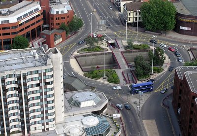
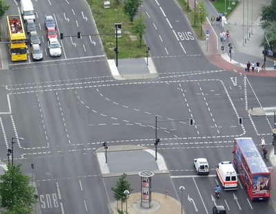
Traffic congestion is a threat to the economical, environmental, social and sustainable development of a city. The traffic management has always been an issue of concern for urban areas of a city. Geographic information system (GIS) offers an effective solution to the traffic management of a city and it helps the peoples to find out necessary information regarding traffic, road, location and direction of a destination. General traffic system is limited in data sharing and it is difficult to achieve integration in data processing. In this work, an urban traffic management system based on geographic information system (GIS) is implemented to handle the roads, landmarks, sensitive areas and traffic information for urban traffic police locus. Our work solves various traffic related problems and retrieves the traffic centres that have to be alert in different situations. The detected shortest path is visualized with the connected paths in our approach.
Related Topics


- Type
- article
- Language
- en
- Landing Page
- https://doi.org/10.1504/ijstmis.2019.103559
- OA Status
- diamond
- Cited By
- 5
- Related Works
- 10
- OpenAlex ID
- https://openalex.org/W4238365123
Raw OpenAlex JSON
- OpenAlex ID
-
https://openalex.org/W4238365123Canonical identifier for this work in OpenAlex
- DOI
-
https://doi.org/10.1504/ijstmis.2019.103559Digital Object Identifier
- Title
-
An approach to GIS-based traffic information system using Spatial OracleWork title
- Type
-
articleOpenAlex work type
- Language
-
enPrimary language
- Publication year
-
2019Year of publication
- Publication date
-
2019-01-01Full publication date if available
- Authors
-
Subhas Barman, Atanu Sarkar, Rajat Kamal Roy, Sourav Saha, Kajal Rajak, Joydeep SarkarList of authors in order
- Landing page
-
https://doi.org/10.1504/ijstmis.2019.103559Publisher landing page
- Open access
-
YesWhether a free full text is available
- OA status
-
diamondOpen access status per OpenAlex
- OA URL
-
https://doi.org/10.1504/ijstmis.2019.103559Direct OA link when available
- Concepts
-
Geographic information system, Computer science, Transport engineering, Traffic congestion, Information system, Vehicle Information and Communication System, Oracle, Floating car data, Work (physics), Traffic conflict, Geography, Road traffic, Engineering, Cartography, Electrical engineering, Mechanical engineering, Software engineeringTop concepts (fields/topics) attached by OpenAlex
- Cited by
-
5Total citation count in OpenAlex
- Citations by year (recent)
-
2024: 2, 2021: 2, 2020: 1Per-year citation counts (last 5 years)
- Related works (count)
-
10Other works algorithmically related by OpenAlex
Full payload
| id | https://openalex.org/W4238365123 |
|---|---|
| doi | https://doi.org/10.1504/ijstmis.2019.103559 |
| ids.doi | https://doi.org/10.1504/ijstmis.2019.103559 |
| ids.openalex | https://openalex.org/W4238365123 |
| fwci | 0.52086231 |
| type | article |
| title | An approach to GIS-based traffic information system using Spatial Oracle |
| biblio.issue | 3 |
| biblio.volume | 1 |
| biblio.last_page | 253 |
| biblio.first_page | 253 |
| topics[0].id | https://openalex.org/T11344 |
| topics[0].field.id | https://openalex.org/fields/22 |
| topics[0].field.display_name | Engineering |
| topics[0].score | 0.9926000237464905 |
| topics[0].domain.id | https://openalex.org/domains/3 |
| topics[0].domain.display_name | Physical Sciences |
| topics[0].subfield.id | https://openalex.org/subfields/2215 |
| topics[0].subfield.display_name | Building and Construction |
| topics[0].display_name | Traffic Prediction and Management Techniques |
| topics[1].id | https://openalex.org/T11106 |
| topics[1].field.id | https://openalex.org/fields/17 |
| topics[1].field.display_name | Computer Science |
| topics[1].score | 0.9513000249862671 |
| topics[1].domain.id | https://openalex.org/domains/3 |
| topics[1].domain.display_name | Physical Sciences |
| topics[1].subfield.id | https://openalex.org/subfields/1711 |
| topics[1].subfield.display_name | Signal Processing |
| topics[1].display_name | Data Management and Algorithms |
| is_xpac | False |
| apc_list | |
| apc_paid | |
| concepts[0].id | https://openalex.org/C41856607 |
| concepts[0].level | 2 |
| concepts[0].score | 0.6478846073150635 |
| concepts[0].wikidata | https://www.wikidata.org/wiki/Q483130 |
| concepts[0].display_name | Geographic information system |
| concepts[1].id | https://openalex.org/C41008148 |
| concepts[1].level | 0 |
| concepts[1].score | 0.5650737285614014 |
| concepts[1].wikidata | https://www.wikidata.org/wiki/Q21198 |
| concepts[1].display_name | Computer science |
| concepts[2].id | https://openalex.org/C22212356 |
| concepts[2].level | 1 |
| concepts[2].score | 0.5590617656707764 |
| concepts[2].wikidata | https://www.wikidata.org/wiki/Q775325 |
| concepts[2].display_name | Transport engineering |
| concepts[3].id | https://openalex.org/C2779888511 |
| concepts[3].level | 2 |
| concepts[3].score | 0.5333846211433411 |
| concepts[3].wikidata | https://www.wikidata.org/wiki/Q244156 |
| concepts[3].display_name | Traffic congestion |
| concepts[4].id | https://openalex.org/C180198813 |
| concepts[4].level | 2 |
| concepts[4].score | 0.4770445227622986 |
| concepts[4].wikidata | https://www.wikidata.org/wiki/Q121182 |
| concepts[4].display_name | Information system |
| concepts[5].id | https://openalex.org/C146799927 |
| concepts[5].level | 3 |
| concepts[5].score | 0.4698575735092163 |
| concepts[5].wikidata | https://www.wikidata.org/wiki/Q4420920 |
| concepts[5].display_name | Vehicle Information and Communication System |
| concepts[6].id | https://openalex.org/C55166926 |
| concepts[6].level | 2 |
| concepts[6].score | 0.4697796702384949 |
| concepts[6].wikidata | https://www.wikidata.org/wiki/Q2892946 |
| concepts[6].display_name | Oracle |
| concepts[7].id | https://openalex.org/C64093975 |
| concepts[7].level | 3 |
| concepts[7].score | 0.45338356494903564 |
| concepts[7].wikidata | https://www.wikidata.org/wiki/Q356677 |
| concepts[7].display_name | Floating car data |
| concepts[8].id | https://openalex.org/C18762648 |
| concepts[8].level | 2 |
| concepts[8].score | 0.440693736076355 |
| concepts[8].wikidata | https://www.wikidata.org/wiki/Q42213 |
| concepts[8].display_name | Work (physics) |
| concepts[9].id | https://openalex.org/C178944661 |
| concepts[9].level | 4 |
| concepts[9].score | 0.42497843503952026 |
| concepts[9].wikidata | https://www.wikidata.org/wiki/Q7832489 |
| concepts[9].display_name | Traffic conflict |
| concepts[10].id | https://openalex.org/C205649164 |
| concepts[10].level | 0 |
| concepts[10].score | 0.3428686559200287 |
| concepts[10].wikidata | https://www.wikidata.org/wiki/Q1071 |
| concepts[10].display_name | Geography |
| concepts[11].id | https://openalex.org/C2985695025 |
| concepts[11].level | 2 |
| concepts[11].score | 0.2939789891242981 |
| concepts[11].wikidata | https://www.wikidata.org/wiki/Q4323994 |
| concepts[11].display_name | Road traffic |
| concepts[12].id | https://openalex.org/C127413603 |
| concepts[12].level | 0 |
| concepts[12].score | 0.12817621231079102 |
| concepts[12].wikidata | https://www.wikidata.org/wiki/Q11023 |
| concepts[12].display_name | Engineering |
| concepts[13].id | https://openalex.org/C58640448 |
| concepts[13].level | 1 |
| concepts[13].score | 0.11311718821525574 |
| concepts[13].wikidata | https://www.wikidata.org/wiki/Q42515 |
| concepts[13].display_name | Cartography |
| concepts[14].id | https://openalex.org/C119599485 |
| concepts[14].level | 1 |
| concepts[14].score | 0.0 |
| concepts[14].wikidata | https://www.wikidata.org/wiki/Q43035 |
| concepts[14].display_name | Electrical engineering |
| concepts[15].id | https://openalex.org/C78519656 |
| concepts[15].level | 1 |
| concepts[15].score | 0.0 |
| concepts[15].wikidata | https://www.wikidata.org/wiki/Q101333 |
| concepts[15].display_name | Mechanical engineering |
| concepts[16].id | https://openalex.org/C115903868 |
| concepts[16].level | 1 |
| concepts[16].score | 0.0 |
| concepts[16].wikidata | https://www.wikidata.org/wiki/Q80993 |
| concepts[16].display_name | Software engineering |
| keywords[0].id | https://openalex.org/keywords/geographic-information-system |
| keywords[0].score | 0.6478846073150635 |
| keywords[0].display_name | Geographic information system |
| keywords[1].id | https://openalex.org/keywords/computer-science |
| keywords[1].score | 0.5650737285614014 |
| keywords[1].display_name | Computer science |
| keywords[2].id | https://openalex.org/keywords/transport-engineering |
| keywords[2].score | 0.5590617656707764 |
| keywords[2].display_name | Transport engineering |
| keywords[3].id | https://openalex.org/keywords/traffic-congestion |
| keywords[3].score | 0.5333846211433411 |
| keywords[3].display_name | Traffic congestion |
| keywords[4].id | https://openalex.org/keywords/information-system |
| keywords[4].score | 0.4770445227622986 |
| keywords[4].display_name | Information system |
| keywords[5].id | https://openalex.org/keywords/vehicle-information-and-communication-system |
| keywords[5].score | 0.4698575735092163 |
| keywords[5].display_name | Vehicle Information and Communication System |
| keywords[6].id | https://openalex.org/keywords/oracle |
| keywords[6].score | 0.4697796702384949 |
| keywords[6].display_name | Oracle |
| keywords[7].id | https://openalex.org/keywords/floating-car-data |
| keywords[7].score | 0.45338356494903564 |
| keywords[7].display_name | Floating car data |
| keywords[8].id | https://openalex.org/keywords/work |
| keywords[8].score | 0.440693736076355 |
| keywords[8].display_name | Work (physics) |
| keywords[9].id | https://openalex.org/keywords/traffic-conflict |
| keywords[9].score | 0.42497843503952026 |
| keywords[9].display_name | Traffic conflict |
| keywords[10].id | https://openalex.org/keywords/geography |
| keywords[10].score | 0.3428686559200287 |
| keywords[10].display_name | Geography |
| keywords[11].id | https://openalex.org/keywords/road-traffic |
| keywords[11].score | 0.2939789891242981 |
| keywords[11].display_name | Road traffic |
| keywords[12].id | https://openalex.org/keywords/engineering |
| keywords[12].score | 0.12817621231079102 |
| keywords[12].display_name | Engineering |
| keywords[13].id | https://openalex.org/keywords/cartography |
| keywords[13].score | 0.11311718821525574 |
| keywords[13].display_name | Cartography |
| language | en |
| locations[0].id | doi:10.1504/ijstmis.2019.103559 |
| locations[0].is_oa | True |
| locations[0].source.id | https://openalex.org/S4210180695 |
| locations[0].source.issn | 2052-3556, 2052-3564 |
| locations[0].source.type | journal |
| locations[0].source.is_oa | True |
| locations[0].source.issn_l | 2052-3556 |
| locations[0].source.is_core | False |
| locations[0].source.is_in_doaj | False |
| locations[0].source.display_name | International Journal of Spatial Temporal and Multimedia Information Systems |
| locations[0].source.host_organization | |
| locations[0].source.host_organization_name | |
| locations[0].license | |
| locations[0].pdf_url | |
| locations[0].version | publishedVersion |
| locations[0].raw_type | journal-article |
| locations[0].license_id | |
| locations[0].is_accepted | True |
| locations[0].is_published | True |
| locations[0].raw_source_name | International Journal of Spatial, Temporal and Multimedia Information Systems |
| locations[0].landing_page_url | https://doi.org/10.1504/ijstmis.2019.103559 |
| indexed_in | crossref |
| authorships[0].author.id | https://openalex.org/A5004981968 |
| authorships[0].author.orcid | https://orcid.org/0000-0002-3206-1110 |
| authorships[0].author.display_name | Subhas Barman |
| authorships[0].affiliations[0].raw_affiliation_string | Department of Computer Science and Engineering, Jalpaiguri Government Engineering College, Jalpaiguri, West Bengal, 735101, India |
| authorships[0].author_position | first |
| authorships[0].raw_author_name | Subhas Barman |
| authorships[0].is_corresponding | False |
| authorships[0].raw_affiliation_strings | Department of Computer Science and Engineering, Jalpaiguri Government Engineering College, Jalpaiguri, West Bengal, 735101, India |
| authorships[1].author.id | https://openalex.org/A5025630055 |
| authorships[1].author.orcid | https://orcid.org/0000-0003-1797-4971 |
| authorships[1].author.display_name | Atanu Sarkar |
| authorships[1].affiliations[0].raw_affiliation_string | Department of Computer Science and Engineering, Jalpaiguri Government Engineering College, Jalpaiguri, West Bengal, 735101, India |
| authorships[1].author_position | middle |
| authorships[1].raw_author_name | Atanu Sarkar |
| authorships[1].is_corresponding | False |
| authorships[1].raw_affiliation_strings | Department of Computer Science and Engineering, Jalpaiguri Government Engineering College, Jalpaiguri, West Bengal, 735101, India |
| authorships[2].author.id | https://openalex.org/A5055459174 |
| authorships[2].author.orcid | |
| authorships[2].author.display_name | Rajat Kamal Roy |
| authorships[2].affiliations[0].raw_affiliation_string | Department of Computer Science and Engineering, Jalpaiguri Government Engineering College, Jalpaiguri, West Bengal, 735101, India |
| authorships[2].author_position | middle |
| authorships[2].raw_author_name | Rajat Kamal Roy |
| authorships[2].is_corresponding | False |
| authorships[2].raw_affiliation_strings | Department of Computer Science and Engineering, Jalpaiguri Government Engineering College, Jalpaiguri, West Bengal, 735101, India |
| authorships[3].author.id | https://openalex.org/A5051854259 |
| authorships[3].author.orcid | https://orcid.org/0000-0001-7242-5540 |
| authorships[3].author.display_name | Sourav Saha |
| authorships[3].affiliations[0].raw_affiliation_string | Department of Computer Science and Engineering, Jalpaiguri Government Engineering College, Jalpaiguri, West Bengal, 735101, India |
| authorships[3].author_position | middle |
| authorships[3].raw_author_name | Sourav Saha |
| authorships[3].is_corresponding | False |
| authorships[3].raw_affiliation_strings | Department of Computer Science and Engineering, Jalpaiguri Government Engineering College, Jalpaiguri, West Bengal, 735101, India |
| authorships[4].author.id | https://openalex.org/A5034293335 |
| authorships[4].author.orcid | |
| authorships[4].author.display_name | Kajal Rajak |
| authorships[4].affiliations[0].raw_affiliation_string | Department of Computer Science and Engineering, Jalpaiguri Government Engineering College, Jalpaiguri, West Bengal, 735101, India |
| authorships[4].author_position | middle |
| authorships[4].raw_author_name | Kajal Rajak |
| authorships[4].is_corresponding | False |
| authorships[4].raw_affiliation_strings | Department of Computer Science and Engineering, Jalpaiguri Government Engineering College, Jalpaiguri, West Bengal, 735101, India |
| authorships[5].author.id | https://openalex.org/A5005301360 |
| authorships[5].author.orcid | |
| authorships[5].author.display_name | Joydeep Sarkar |
| authorships[5].affiliations[0].raw_affiliation_string | Department of Computer Science and Engineering, Jalpaiguri Government Engineering College, Jalpaiguri, West Bengal, 735101, India |
| authorships[5].author_position | last |
| authorships[5].raw_author_name | Joydeep Sarkar |
| authorships[5].is_corresponding | False |
| authorships[5].raw_affiliation_strings | Department of Computer Science and Engineering, Jalpaiguri Government Engineering College, Jalpaiguri, West Bengal, 735101, India |
| has_content.pdf | False |
| has_content.grobid_xml | False |
| is_paratext | False |
| open_access.is_oa | True |
| open_access.oa_url | https://doi.org/10.1504/ijstmis.2019.103559 |
| open_access.oa_status | diamond |
| open_access.any_repository_has_fulltext | False |
| created_date | 2025-10-10T00:00:00 |
| display_name | An approach to GIS-based traffic information system using Spatial Oracle |
| has_fulltext | False |
| is_retracted | False |
| updated_date | 2025-11-06T03:46:38.306776 |
| primary_topic.id | https://openalex.org/T11344 |
| primary_topic.field.id | https://openalex.org/fields/22 |
| primary_topic.field.display_name | Engineering |
| primary_topic.score | 0.9926000237464905 |
| primary_topic.domain.id | https://openalex.org/domains/3 |
| primary_topic.domain.display_name | Physical Sciences |
| primary_topic.subfield.id | https://openalex.org/subfields/2215 |
| primary_topic.subfield.display_name | Building and Construction |
| primary_topic.display_name | Traffic Prediction and Management Techniques |
| related_works | https://openalex.org/W751599861, https://openalex.org/W2590876133, https://openalex.org/W2945875309, https://openalex.org/W4220875044, https://openalex.org/W1964934390, https://openalex.org/W612432039, https://openalex.org/W2552531011, https://openalex.org/W3117279048, https://openalex.org/W4385779953, https://openalex.org/W2898775471 |
| cited_by_count | 5 |
| counts_by_year[0].year | 2024 |
| counts_by_year[0].cited_by_count | 2 |
| counts_by_year[1].year | 2021 |
| counts_by_year[1].cited_by_count | 2 |
| counts_by_year[2].year | 2020 |
| counts_by_year[2].cited_by_count | 1 |
| locations_count | 1 |
| best_oa_location.id | doi:10.1504/ijstmis.2019.103559 |
| best_oa_location.is_oa | True |
| best_oa_location.source.id | https://openalex.org/S4210180695 |
| best_oa_location.source.issn | 2052-3556, 2052-3564 |
| best_oa_location.source.type | journal |
| best_oa_location.source.is_oa | True |
| best_oa_location.source.issn_l | 2052-3556 |
| best_oa_location.source.is_core | False |
| best_oa_location.source.is_in_doaj | False |
| best_oa_location.source.display_name | International Journal of Spatial Temporal and Multimedia Information Systems |
| best_oa_location.source.host_organization | |
| best_oa_location.source.host_organization_name | |
| best_oa_location.license | |
| best_oa_location.pdf_url | |
| best_oa_location.version | publishedVersion |
| best_oa_location.raw_type | journal-article |
| best_oa_location.license_id | |
| best_oa_location.is_accepted | True |
| best_oa_location.is_published | True |
| best_oa_location.raw_source_name | International Journal of Spatial, Temporal and Multimedia Information Systems |
| best_oa_location.landing_page_url | https://doi.org/10.1504/ijstmis.2019.103559 |
| primary_location.id | doi:10.1504/ijstmis.2019.103559 |
| primary_location.is_oa | True |
| primary_location.source.id | https://openalex.org/S4210180695 |
| primary_location.source.issn | 2052-3556, 2052-3564 |
| primary_location.source.type | journal |
| primary_location.source.is_oa | True |
| primary_location.source.issn_l | 2052-3556 |
| primary_location.source.is_core | False |
| primary_location.source.is_in_doaj | False |
| primary_location.source.display_name | International Journal of Spatial Temporal and Multimedia Information Systems |
| primary_location.source.host_organization | |
| primary_location.source.host_organization_name | |
| primary_location.license | |
| primary_location.pdf_url | |
| primary_location.version | publishedVersion |
| primary_location.raw_type | journal-article |
| primary_location.license_id | |
| primary_location.is_accepted | True |
| primary_location.is_published | True |
| primary_location.raw_source_name | International Journal of Spatial, Temporal and Multimedia Information Systems |
| primary_location.landing_page_url | https://doi.org/10.1504/ijstmis.2019.103559 |
| publication_date | 2019-01-01 |
| publication_year | 2019 |
| referenced_works_count | 0 |
| abstract_inverted_index.a | 3, 14, 30, 45, 64 |
| abstract_inverted_index.In | 84 |
| abstract_inverted_index.an | 22, 37, 87 |
| abstract_inverted_index.be | 130 |
| abstract_inverted_index.in | 71, 81, 132, 145 |
| abstract_inverted_index.is | 2, 69, 76, 98, 139 |
| abstract_inverted_index.it | 48, 75 |
| abstract_inverted_index.of | 13, 24, 29, 44, 63 |
| abstract_inverted_index.on | 93 |
| abstract_inverted_index.to | 5, 40, 52, 78, 100, 129 |
| abstract_inverted_index.Our | 115 |
| abstract_inverted_index.The | 16, 135 |
| abstract_inverted_index.and | 10, 47, 61, 74, 107, 122 |
| abstract_inverted_index.for | 26, 110 |
| abstract_inverted_index.has | 19 |
| abstract_inverted_index.our | 146 |
| abstract_inverted_index.out | 54 |
| abstract_inverted_index.the | 6, 41, 50, 102, 124, 142 |
| abstract_inverted_index.been | 21 |
| abstract_inverted_index.city | 46 |
| abstract_inverted_index.data | 72, 82 |
| abstract_inverted_index.find | 53 |
| abstract_inverted_index.have | 128 |
| abstract_inverted_index.path | 138 |
| abstract_inverted_index.that | 127 |
| abstract_inverted_index.this | 85 |
| abstract_inverted_index.with | 141 |
| abstract_inverted_index.work | 116 |
| abstract_inverted_index.(GIS) | 35, 97 |
| abstract_inverted_index.alert | 131 |
| abstract_inverted_index.areas | 28, 106 |
| abstract_inverted_index.based | 92 |
| abstract_inverted_index.city. | 15, 31 |
| abstract_inverted_index.helps | 49 |
| abstract_inverted_index.issue | 23 |
| abstract_inverted_index.paths | 144 |
| abstract_inverted_index.road, | 59 |
| abstract_inverted_index.urban | 27, 88, 111 |
| abstract_inverted_index.work, | 86 |
| abstract_inverted_index.always | 20 |
| abstract_inverted_index.handle | 101 |
| abstract_inverted_index.locus. | 114 |
| abstract_inverted_index.offers | 36 |
| abstract_inverted_index.police | 113 |
| abstract_inverted_index.roads, | 103 |
| abstract_inverted_index.social | 9 |
| abstract_inverted_index.solves | 117 |
| abstract_inverted_index.system | 34, 68, 91, 96 |
| abstract_inverted_index.threat | 4 |
| abstract_inverted_index.General | 66 |
| abstract_inverted_index.Traffic | 0 |
| abstract_inverted_index.achieve | 79 |
| abstract_inverted_index.centres | 126 |
| abstract_inverted_index.concern | 25 |
| abstract_inverted_index.limited | 70 |
| abstract_inverted_index.peoples | 51 |
| abstract_inverted_index.related | 120 |
| abstract_inverted_index.sharing | 73 |
| abstract_inverted_index.traffic | 17, 42, 67, 89, 108, 112, 119, 125 |
| abstract_inverted_index.various | 118 |
| abstract_inverted_index.detected | 136 |
| abstract_inverted_index.location | 60 |
| abstract_inverted_index.problems | 121 |
| abstract_inverted_index.shortest | 137 |
| abstract_inverted_index.solution | 39 |
| abstract_inverted_index.traffic, | 58 |
| abstract_inverted_index.approach. | 147 |
| abstract_inverted_index.connected | 143 |
| abstract_inverted_index.different | 133 |
| abstract_inverted_index.difficult | 77 |
| abstract_inverted_index.direction | 62 |
| abstract_inverted_index.effective | 38 |
| abstract_inverted_index.necessary | 55 |
| abstract_inverted_index.regarding | 57 |
| abstract_inverted_index.retrieves | 123 |
| abstract_inverted_index.sensitive | 105 |
| abstract_inverted_index.Geographic | 32 |
| abstract_inverted_index.congestion | 1 |
| abstract_inverted_index.geographic | 94 |
| abstract_inverted_index.landmarks, | 104 |
| abstract_inverted_index.management | 18, 43, 90 |
| abstract_inverted_index.visualized | 140 |
| abstract_inverted_index.development | 12 |
| abstract_inverted_index.economical, | 7 |
| abstract_inverted_index.implemented | 99 |
| abstract_inverted_index.information | 33, 56, 95, 109 |
| abstract_inverted_index.integration | 80 |
| abstract_inverted_index.processing. | 83 |
| abstract_inverted_index.situations. | 134 |
| abstract_inverted_index.sustainable | 11 |
| abstract_inverted_index.destination. | 65 |
| abstract_inverted_index.environmental, | 8 |
| cited_by_percentile_year.max | 96 |
| cited_by_percentile_year.min | 89 |
| countries_distinct_count | 0 |
| institutions_distinct_count | 6 |
| sustainable_development_goals[0].id | https://metadata.un.org/sdg/11 |
| sustainable_development_goals[0].score | 0.6299999952316284 |
| sustainable_development_goals[0].display_name | Sustainable cities and communities |
| citation_normalized_percentile.value | 0.69642994 |
| citation_normalized_percentile.is_in_top_1_percent | False |
| citation_normalized_percentile.is_in_top_10_percent | False |