Detailed land cover mapping in a seasonally dry tropical forest landscape using multiple sensor types Article Swipe

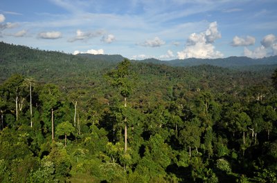
Detailed mapping of land cover is essential for supporting science-based sustainable landscape management. Despite the importance of land cover mapping in monitoring landscapes dynamics, land cover data are not always available. Even when the land cover data are available, they often lack detailed discrimination between forest types and plantations. This issue was found in a seasonally dry tropical forest landscape in Siem Reap and Preah Vihear, Cambodia. In this thesis, I explored the potential of (1) the fusion of optical and radar data in developing detailed land cover maps and revealing the driver of landscape change, and (2) vertical vegetation structure acquired by the Global Ecosystem Dynamics Investigation (GEDI) mission—a new mission that harnesses a space-borne waveform lidar sensor installed on the International Space Station—to improve the vegetation mapping in the studied landscape. The fusion between radar (Sentinel-1) and optical (Sentinel-2) satellite data slightly improved the land cover classification accuracy (1.6% overall accuracy increase) relative to Sentinel-2-only classification. Between 2015 and 2019, I detected a 247,781.04 Ha dry deciduous forest loss; most were due to logging (147,314 Ha). Land designations, such as the protected areas and the economic land concessions (ELCs), significantly determine land cover change. The classification of vegetation types using GEDI data had 81.9% overall accuracy despite the limited spatial coverage of GEDI data. The GEDI-only classification results could identify the seasonally inundated forests with better accuracy than the land cover map derived from the fusion of optical-radar data. These results demonstrate the potential of structural information acquired by Sentinel-1 and GEDI to improve our ability to identify vegetation types in complex, heterogeneous landscapes.
Related Topics


- Type
- article
- Language
- en
- Landing Page
- https://doi.org/10.14288/1.0402360
- OA Status
- green
- Cited By
- 1
- Related Works
- 20
- OpenAlex ID
- https://openalex.org/W3203611529
Raw OpenAlex JSON
- OpenAlex ID
-
https://openalex.org/W3203611529Canonical identifier for this work in OpenAlex
- DOI
-
https://doi.org/10.14288/1.0402360Digital Object Identifier
- Title
-
Detailed land cover mapping in a seasonally dry tropical forest landscape using multiple sensor typesWork title
- Type
-
articleOpenAlex work type
- Language
-
enPrimary language
- Publication year
-
2021Year of publication
- Publication date
-
2021-01-01Full publication date if available
- Authors
-
Adrian DwiputraList of authors in order
- Landing page
-
https://doi.org/10.14288/1.0402360Publisher landing page
- Open access
-
YesWhether a free full text is available
- OA status
-
greenOpen access status per OpenAlex
- OA URL
-
https://doi.org/10.14288/1.0402360Direct OA link when available
- Concepts
-
Land cover, Cover (algebra), Tropical and subtropical dry broadleaf forests, Tropical forest, Forest cover, Geography, Remote sensing, Environmental science, Dry land, Tropics, Forestry, Land use, Ecology, Biology, Agronomy, Mechanical engineering, EngineeringTop concepts (fields/topics) attached by OpenAlex
- Cited by
-
1Total citation count in OpenAlex
- Citations by year (recent)
-
2023: 1Per-year citation counts (last 5 years)
- Related works (count)
-
20Other works algorithmically related by OpenAlex
Full payload
| id | https://openalex.org/W3203611529 |
|---|---|
| doi | https://doi.org/10.14288/1.0402360 |
| ids.doi | https://doi.org/10.14288/1.0402360 |
| ids.mag | 3203611529 |
| ids.openalex | https://openalex.org/W3203611529 |
| fwci | 0.10277887 |
| type | article |
| title | Detailed land cover mapping in a seasonally dry tropical forest landscape using multiple sensor types |
| biblio.issue | |
| biblio.volume | |
| biblio.last_page | |
| biblio.first_page | |
| topics[0].id | https://openalex.org/T13890 |
| topics[0].field.id | https://openalex.org/fields/19 |
| topics[0].field.display_name | Earth and Planetary Sciences |
| topics[0].score | 0.7997999787330627 |
| topics[0].domain.id | https://openalex.org/domains/3 |
| topics[0].domain.display_name | Physical Sciences |
| topics[0].subfield.id | https://openalex.org/subfields/1902 |
| topics[0].subfield.display_name | Atmospheric Science |
| topics[0].display_name | Remote Sensing and Land Use |
| topics[1].id | https://openalex.org/T10644 |
| topics[1].field.id | https://openalex.org/fields/19 |
| topics[1].field.display_name | Earth and Planetary Sciences |
| topics[1].score | 0.7336999773979187 |
| topics[1].domain.id | https://openalex.org/domains/3 |
| topics[1].domain.display_name | Physical Sciences |
| topics[1].subfield.id | https://openalex.org/subfields/1902 |
| topics[1].subfield.display_name | Atmospheric Science |
| topics[1].display_name | Cryospheric studies and observations |
| topics[2].id | https://openalex.org/T10689 |
| topics[2].field.id | https://openalex.org/fields/22 |
| topics[2].field.display_name | Engineering |
| topics[2].score | 0.696399986743927 |
| topics[2].domain.id | https://openalex.org/domains/3 |
| topics[2].domain.display_name | Physical Sciences |
| topics[2].subfield.id | https://openalex.org/subfields/2214 |
| topics[2].subfield.display_name | Media Technology |
| topics[2].display_name | Remote-Sensing Image Classification |
| is_xpac | False |
| apc_list | |
| apc_paid | |
| concepts[0].id | https://openalex.org/C2780648208 |
| concepts[0].level | 3 |
| concepts[0].score | 0.7377111911773682 |
| concepts[0].wikidata | https://www.wikidata.org/wiki/Q3001793 |
| concepts[0].display_name | Land cover |
| concepts[1].id | https://openalex.org/C2780428219 |
| concepts[1].level | 2 |
| concepts[1].score | 0.5780835151672363 |
| concepts[1].wikidata | https://www.wikidata.org/wiki/Q16952335 |
| concepts[1].display_name | Cover (algebra) |
| concepts[2].id | https://openalex.org/C108216600 |
| concepts[2].level | 2 |
| concepts[2].score | 0.5753878951072693 |
| concepts[2].wikidata | https://www.wikidata.org/wiki/Q511668 |
| concepts[2].display_name | Tropical and subtropical dry broadleaf forests |
| concepts[3].id | https://openalex.org/C2776285232 |
| concepts[3].level | 2 |
| concepts[3].score | 0.5699753761291504 |
| concepts[3].wikidata | https://www.wikidata.org/wiki/Q1048194 |
| concepts[3].display_name | Tropical forest |
| concepts[4].id | https://openalex.org/C2986088632 |
| concepts[4].level | 2 |
| concepts[4].score | 0.5428540706634521 |
| concepts[4].wikidata | https://www.wikidata.org/wiki/Q4259364 |
| concepts[4].display_name | Forest cover |
| concepts[5].id | https://openalex.org/C205649164 |
| concepts[5].level | 0 |
| concepts[5].score | 0.5377979278564453 |
| concepts[5].wikidata | https://www.wikidata.org/wiki/Q1071 |
| concepts[5].display_name | Geography |
| concepts[6].id | https://openalex.org/C62649853 |
| concepts[6].level | 1 |
| concepts[6].score | 0.46778926253318787 |
| concepts[6].wikidata | https://www.wikidata.org/wiki/Q199687 |
| concepts[6].display_name | Remote sensing |
| concepts[7].id | https://openalex.org/C39432304 |
| concepts[7].level | 0 |
| concepts[7].score | 0.4588312804698944 |
| concepts[7].wikidata | https://www.wikidata.org/wiki/Q188847 |
| concepts[7].display_name | Environmental science |
| concepts[8].id | https://openalex.org/C2993264327 |
| concepts[8].level | 2 |
| concepts[8].score | 0.4557376503944397 |
| concepts[8].wikidata | https://www.wikidata.org/wiki/Q11081619 |
| concepts[8].display_name | Dry land |
| concepts[9].id | https://openalex.org/C50660011 |
| concepts[9].level | 2 |
| concepts[9].score | 0.44781965017318726 |
| concepts[9].wikidata | https://www.wikidata.org/wiki/Q42530 |
| concepts[9].display_name | Tropics |
| concepts[10].id | https://openalex.org/C97137747 |
| concepts[10].level | 1 |
| concepts[10].score | 0.33099493384361267 |
| concepts[10].wikidata | https://www.wikidata.org/wiki/Q38112 |
| concepts[10].display_name | Forestry |
| concepts[11].id | https://openalex.org/C4792198 |
| concepts[11].level | 2 |
| concepts[11].score | 0.29438966512680054 |
| concepts[11].wikidata | https://www.wikidata.org/wiki/Q1165944 |
| concepts[11].display_name | Land use |
| concepts[12].id | https://openalex.org/C18903297 |
| concepts[12].level | 1 |
| concepts[12].score | 0.2454589605331421 |
| concepts[12].wikidata | https://www.wikidata.org/wiki/Q7150 |
| concepts[12].display_name | Ecology |
| concepts[13].id | https://openalex.org/C86803240 |
| concepts[13].level | 0 |
| concepts[13].score | 0.07822978496551514 |
| concepts[13].wikidata | https://www.wikidata.org/wiki/Q420 |
| concepts[13].display_name | Biology |
| concepts[14].id | https://openalex.org/C6557445 |
| concepts[14].level | 1 |
| concepts[14].score | 0.06670793890953064 |
| concepts[14].wikidata | https://www.wikidata.org/wiki/Q173113 |
| concepts[14].display_name | Agronomy |
| concepts[15].id | https://openalex.org/C78519656 |
| concepts[15].level | 1 |
| concepts[15].score | 0.0 |
| concepts[15].wikidata | https://www.wikidata.org/wiki/Q101333 |
| concepts[15].display_name | Mechanical engineering |
| concepts[16].id | https://openalex.org/C127413603 |
| concepts[16].level | 0 |
| concepts[16].score | 0.0 |
| concepts[16].wikidata | https://www.wikidata.org/wiki/Q11023 |
| concepts[16].display_name | Engineering |
| keywords[0].id | https://openalex.org/keywords/land-cover |
| keywords[0].score | 0.7377111911773682 |
| keywords[0].display_name | Land cover |
| keywords[1].id | https://openalex.org/keywords/cover |
| keywords[1].score | 0.5780835151672363 |
| keywords[1].display_name | Cover (algebra) |
| keywords[2].id | https://openalex.org/keywords/tropical-and-subtropical-dry-broadleaf-forests |
| keywords[2].score | 0.5753878951072693 |
| keywords[2].display_name | Tropical and subtropical dry broadleaf forests |
| keywords[3].id | https://openalex.org/keywords/tropical-forest |
| keywords[3].score | 0.5699753761291504 |
| keywords[3].display_name | Tropical forest |
| keywords[4].id | https://openalex.org/keywords/forest-cover |
| keywords[4].score | 0.5428540706634521 |
| keywords[4].display_name | Forest cover |
| keywords[5].id | https://openalex.org/keywords/geography |
| keywords[5].score | 0.5377979278564453 |
| keywords[5].display_name | Geography |
| keywords[6].id | https://openalex.org/keywords/remote-sensing |
| keywords[6].score | 0.46778926253318787 |
| keywords[6].display_name | Remote sensing |
| keywords[7].id | https://openalex.org/keywords/environmental-science |
| keywords[7].score | 0.4588312804698944 |
| keywords[7].display_name | Environmental science |
| keywords[8].id | https://openalex.org/keywords/dry-land |
| keywords[8].score | 0.4557376503944397 |
| keywords[8].display_name | Dry land |
| keywords[9].id | https://openalex.org/keywords/tropics |
| keywords[9].score | 0.44781965017318726 |
| keywords[9].display_name | Tropics |
| keywords[10].id | https://openalex.org/keywords/forestry |
| keywords[10].score | 0.33099493384361267 |
| keywords[10].display_name | Forestry |
| keywords[11].id | https://openalex.org/keywords/land-use |
| keywords[11].score | 0.29438966512680054 |
| keywords[11].display_name | Land use |
| keywords[12].id | https://openalex.org/keywords/ecology |
| keywords[12].score | 0.2454589605331421 |
| keywords[12].display_name | Ecology |
| keywords[13].id | https://openalex.org/keywords/biology |
| keywords[13].score | 0.07822978496551514 |
| keywords[13].display_name | Biology |
| keywords[14].id | https://openalex.org/keywords/agronomy |
| keywords[14].score | 0.06670793890953064 |
| keywords[14].display_name | Agronomy |
| language | en |
| locations[0].id | doi:10.14288/1.0402360 |
| locations[0].is_oa | True |
| locations[0].source.id | https://openalex.org/S7407053062 |
| locations[0].source.type | repository |
| locations[0].source.is_oa | False |
| locations[0].source.issn_l | |
| locations[0].source.is_core | False |
| locations[0].source.is_in_doaj | False |
| locations[0].source.display_name | Open Collections |
| locations[0].source.host_organization | |
| locations[0].source.host_organization_name | |
| locations[0].source.host_organization_lineage | |
| locations[0].license | |
| locations[0].pdf_url | |
| locations[0].version | |
| locations[0].raw_type | article-journal |
| locations[0].license_id | |
| locations[0].is_accepted | False |
| locations[0].is_published | |
| locations[0].raw_source_name | |
| locations[0].landing_page_url | https://doi.org/10.14288/1.0402360 |
| locations[1].id | mag:3203611529 |
| locations[1].is_oa | False |
| locations[1].source | |
| locations[1].license | |
| locations[1].pdf_url | |
| locations[1].version | |
| locations[1].raw_type | |
| locations[1].license_id | |
| locations[1].is_accepted | False |
| locations[1].is_published | |
| locations[1].raw_source_name | |
| locations[1].landing_page_url | https://open.library.ubc.ca/soa/cIRcle/collections/ubctheses/24/items/1.0402360 |
| indexed_in | datacite |
| authorships[0].author.id | https://openalex.org/A5054951044 |
| authorships[0].author.orcid | https://orcid.org/0000-0002-9325-571X |
| authorships[0].author.display_name | Adrian Dwiputra |
| authorships[0].countries | CA |
| authorships[0].affiliations[0].institution_ids | https://openalex.org/I141945490 |
| authorships[0].affiliations[0].raw_affiliation_string | , University of British Columbia |
| authorships[0].institutions[0].id | https://openalex.org/I141945490 |
| authorships[0].institutions[0].ror | https://ror.org/03rmrcq20 |
| authorships[0].institutions[0].type | education |
| authorships[0].institutions[0].lineage | https://openalex.org/I141945490, https://openalex.org/I4210128534, https://openalex.org/I4210135497, https://openalex.org/I4387154919 |
| authorships[0].institutions[0].country_code | CA |
| authorships[0].institutions[0].display_name | University of British Columbia |
| authorships[0].author_position | first |
| authorships[0].raw_author_name | Adrian Dwiputra |
| authorships[0].is_corresponding | True |
| authorships[0].raw_affiliation_strings | , University of British Columbia |
| has_content.pdf | False |
| has_content.grobid_xml | False |
| is_paratext | False |
| open_access.is_oa | True |
| open_access.oa_url | https://doi.org/10.14288/1.0402360 |
| open_access.oa_status | green |
| open_access.any_repository_has_fulltext | False |
| created_date | 2025-10-10T00:00:00 |
| display_name | Detailed land cover mapping in a seasonally dry tropical forest landscape using multiple sensor types |
| has_fulltext | False |
| is_retracted | False |
| updated_date | 2025-11-06T06:51:31.235846 |
| primary_topic.id | https://openalex.org/T13890 |
| primary_topic.field.id | https://openalex.org/fields/19 |
| primary_topic.field.display_name | Earth and Planetary Sciences |
| primary_topic.score | 0.7997999787330627 |
| primary_topic.domain.id | https://openalex.org/domains/3 |
| primary_topic.domain.display_name | Physical Sciences |
| primary_topic.subfield.id | https://openalex.org/subfields/1902 |
| primary_topic.subfield.display_name | Atmospheric Science |
| primary_topic.display_name | Remote Sensing and Land Use |
| related_works | https://openalex.org/W2388067901, https://openalex.org/W2786867354, https://openalex.org/W3144212594, https://openalex.org/W2550675414, https://openalex.org/W1974012285, https://openalex.org/W95531814, https://openalex.org/W2040714237, https://openalex.org/W2301149451, https://openalex.org/W2789888100, https://openalex.org/W611721383, https://openalex.org/W1907862534, https://openalex.org/W1476604304, https://openalex.org/W2547565383, https://openalex.org/W2793061017, https://openalex.org/W3168719769, https://openalex.org/W2785399082, https://openalex.org/W2971326135, https://openalex.org/W2562204965, https://openalex.org/W280663600, https://openalex.org/W102348197 |
| cited_by_count | 1 |
| counts_by_year[0].year | 2023 |
| counts_by_year[0].cited_by_count | 1 |
| locations_count | 2 |
| best_oa_location.id | doi:10.14288/1.0402360 |
| best_oa_location.is_oa | True |
| best_oa_location.source.id | https://openalex.org/S7407053062 |
| best_oa_location.source.type | repository |
| best_oa_location.source.is_oa | False |
| best_oa_location.source.issn_l | |
| best_oa_location.source.is_core | False |
| best_oa_location.source.is_in_doaj | False |
| best_oa_location.source.display_name | Open Collections |
| best_oa_location.source.host_organization | |
| best_oa_location.source.host_organization_name | |
| best_oa_location.source.host_organization_lineage | |
| best_oa_location.license | |
| best_oa_location.pdf_url | |
| best_oa_location.version | |
| best_oa_location.raw_type | article-journal |
| best_oa_location.license_id | |
| best_oa_location.is_accepted | False |
| best_oa_location.is_published | False |
| best_oa_location.raw_source_name | |
| best_oa_location.landing_page_url | https://doi.org/10.14288/1.0402360 |
| primary_location.id | doi:10.14288/1.0402360 |
| primary_location.is_oa | True |
| primary_location.source.id | https://openalex.org/S7407053062 |
| primary_location.source.type | repository |
| primary_location.source.is_oa | False |
| primary_location.source.issn_l | |
| primary_location.source.is_core | False |
| primary_location.source.is_in_doaj | False |
| primary_location.source.display_name | Open Collections |
| primary_location.source.host_organization | |
| primary_location.source.host_organization_name | |
| primary_location.source.host_organization_lineage | |
| primary_location.license | |
| primary_location.pdf_url | |
| primary_location.version | |
| primary_location.raw_type | article-journal |
| primary_location.license_id | |
| primary_location.is_accepted | False |
| primary_location.is_published | False |
| primary_location.raw_source_name | |
| primary_location.landing_page_url | https://doi.org/10.14288/1.0402360 |
| publication_date | 2021-01-01 |
| publication_year | 2021 |
| referenced_works_count | 0 |
| abstract_inverted_index.I | 70, 162 |
| abstract_inverted_index.a | 54, 114, 164 |
| abstract_inverted_index.Ha | 166 |
| abstract_inverted_index.In | 67 |
| abstract_inverted_index.as | 181 |
| abstract_inverted_index.by | 102, 250 |
| abstract_inverted_index.in | 20, 53, 60, 83, 129, 262 |
| abstract_inverted_index.is | 5 |
| abstract_inverted_index.of | 2, 16, 74, 78, 93, 198, 213, 238, 246 |
| abstract_inverted_index.on | 120 |
| abstract_inverted_index.to | 155, 174, 254, 258 |
| abstract_inverted_index.(1) | 75 |
| abstract_inverted_index.(2) | 97 |
| abstract_inverted_index.The | 133, 196, 216 |
| abstract_inverted_index.and | 47, 63, 80, 89, 96, 138, 160, 185, 252 |
| abstract_inverted_index.are | 27, 37 |
| abstract_inverted_index.dry | 56, 167 |
| abstract_inverted_index.due | 173 |
| abstract_inverted_index.for | 7 |
| abstract_inverted_index.had | 204 |
| abstract_inverted_index.map | 233 |
| abstract_inverted_index.new | 110 |
| abstract_inverted_index.not | 28 |
| abstract_inverted_index.our | 256 |
| abstract_inverted_index.the | 14, 33, 72, 76, 91, 103, 121, 126, 130, 145, 182, 186, 209, 222, 230, 236, 244 |
| abstract_inverted_index.was | 51 |
| abstract_inverted_index.2015 | 159 |
| abstract_inverted_index.Even | 31 |
| abstract_inverted_index.GEDI | 202, 214, 253 |
| abstract_inverted_index.Ha). | 177 |
| abstract_inverted_index.Land | 178 |
| abstract_inverted_index.Reap | 62 |
| abstract_inverted_index.Siem | 61 |
| abstract_inverted_index.This | 49 |
| abstract_inverted_index.data | 26, 36, 82, 142, 203 |
| abstract_inverted_index.from | 235 |
| abstract_inverted_index.lack | 41 |
| abstract_inverted_index.land | 3, 17, 24, 34, 86, 146, 188, 193, 231 |
| abstract_inverted_index.maps | 88 |
| abstract_inverted_index.most | 171 |
| abstract_inverted_index.such | 180 |
| abstract_inverted_index.than | 229 |
| abstract_inverted_index.that | 112 |
| abstract_inverted_index.they | 39 |
| abstract_inverted_index.this | 68 |
| abstract_inverted_index.were | 172 |
| abstract_inverted_index.when | 32 |
| abstract_inverted_index.with | 226 |
| abstract_inverted_index.(1.6% | 150 |
| abstract_inverted_index.2019, | 161 |
| abstract_inverted_index.81.9% | 205 |
| abstract_inverted_index.Preah | 64 |
| abstract_inverted_index.Space | 123 |
| abstract_inverted_index.These | 241 |
| abstract_inverted_index.areas | 184 |
| abstract_inverted_index.could | 220 |
| abstract_inverted_index.cover | 4, 18, 25, 35, 87, 147, 194, 232 |
| abstract_inverted_index.data. | 215, 240 |
| abstract_inverted_index.found | 52 |
| abstract_inverted_index.issue | 50 |
| abstract_inverted_index.lidar | 117 |
| abstract_inverted_index.loss; | 170 |
| abstract_inverted_index.often | 40 |
| abstract_inverted_index.radar | 81, 136 |
| abstract_inverted_index.types | 46, 200, 261 |
| abstract_inverted_index.using | 201 |
| abstract_inverted_index.(GEDI) | 108 |
| abstract_inverted_index.Global | 104 |
| abstract_inverted_index.always | 29 |
| abstract_inverted_index.better | 227 |
| abstract_inverted_index.driver | 92 |
| abstract_inverted_index.forest | 45, 58, 169 |
| abstract_inverted_index.fusion | 77, 134, 237 |
| abstract_inverted_index.sensor | 118 |
| abstract_inverted_index.(ELCs), | 190 |
| abstract_inverted_index.Between | 158 |
| abstract_inverted_index.Despite | 13 |
| abstract_inverted_index.Vihear, | 65 |
| abstract_inverted_index.ability | 257 |
| abstract_inverted_index.between | 44, 135 |
| abstract_inverted_index.change, | 95 |
| abstract_inverted_index.change. | 195 |
| abstract_inverted_index.derived | 234 |
| abstract_inverted_index.despite | 208 |
| abstract_inverted_index.forests | 225 |
| abstract_inverted_index.improve | 125, 255 |
| abstract_inverted_index.limited | 210 |
| abstract_inverted_index.logging | 175 |
| abstract_inverted_index.mapping | 1, 19, 128 |
| abstract_inverted_index.mission | 111 |
| abstract_inverted_index.optical | 79, 139 |
| abstract_inverted_index.overall | 151, 206 |
| abstract_inverted_index.results | 219, 242 |
| abstract_inverted_index.spatial | 211 |
| abstract_inverted_index.studied | 131 |
| abstract_inverted_index.thesis, | 69 |
| abstract_inverted_index.(147,314 | 176 |
| abstract_inverted_index.Detailed | 0 |
| abstract_inverted_index.Dynamics | 106 |
| abstract_inverted_index.accuracy | 149, 152, 207, 228 |
| abstract_inverted_index.acquired | 101, 249 |
| abstract_inverted_index.complex, | 263 |
| abstract_inverted_index.coverage | 212 |
| abstract_inverted_index.detailed | 42, 85 |
| abstract_inverted_index.detected | 163 |
| abstract_inverted_index.economic | 187 |
| abstract_inverted_index.explored | 71 |
| abstract_inverted_index.identify | 221, 259 |
| abstract_inverted_index.improved | 144 |
| abstract_inverted_index.relative | 154 |
| abstract_inverted_index.slightly | 143 |
| abstract_inverted_index.tropical | 57 |
| abstract_inverted_index.vertical | 98 |
| abstract_inverted_index.waveform | 116 |
| abstract_inverted_index.Cambodia. | 66 |
| abstract_inverted_index.Ecosystem | 105 |
| abstract_inverted_index.GEDI-only | 217 |
| abstract_inverted_index.deciduous | 168 |
| abstract_inverted_index.determine | 192 |
| abstract_inverted_index.dynamics, | 23 |
| abstract_inverted_index.essential | 6 |
| abstract_inverted_index.harnesses | 113 |
| abstract_inverted_index.increase) | 153 |
| abstract_inverted_index.installed | 119 |
| abstract_inverted_index.inundated | 224 |
| abstract_inverted_index.landscape | 11, 59, 94 |
| abstract_inverted_index.potential | 73, 245 |
| abstract_inverted_index.protected | 183 |
| abstract_inverted_index.revealing | 90 |
| abstract_inverted_index.satellite | 141 |
| abstract_inverted_index.structure | 100 |
| abstract_inverted_index.247,781.04 | 165 |
| abstract_inverted_index.Sentinel-1 | 251 |
| abstract_inverted_index.available, | 38 |
| abstract_inverted_index.available. | 30 |
| abstract_inverted_index.developing | 84 |
| abstract_inverted_index.importance | 15 |
| abstract_inverted_index.landscape. | 132 |
| abstract_inverted_index.landscapes | 22 |
| abstract_inverted_index.monitoring | 21 |
| abstract_inverted_index.seasonally | 55, 223 |
| abstract_inverted_index.structural | 247 |
| abstract_inverted_index.supporting | 8 |
| abstract_inverted_index.vegetation | 99, 127, 199, 260 |
| abstract_inverted_index.concessions | 189 |
| abstract_inverted_index.demonstrate | 243 |
| abstract_inverted_index.information | 248 |
| abstract_inverted_index.landscapes. | 265 |
| abstract_inverted_index.management. | 12 |
| abstract_inverted_index.mission—a | 109 |
| abstract_inverted_index.space-borne | 115 |
| abstract_inverted_index.sustainable | 10 |
| abstract_inverted_index.(Sentinel-1) | 137 |
| abstract_inverted_index.(Sentinel-2) | 140 |
| abstract_inverted_index.Station—to | 124 |
| abstract_inverted_index.plantations. | 48 |
| abstract_inverted_index.International | 122 |
| abstract_inverted_index.Investigation | 107 |
| abstract_inverted_index.designations, | 179 |
| abstract_inverted_index.heterogeneous | 264 |
| abstract_inverted_index.optical-radar | 239 |
| abstract_inverted_index.science-based | 9 |
| abstract_inverted_index.significantly | 191 |
| abstract_inverted_index.classification | 148, 197, 218 |
| abstract_inverted_index.discrimination | 43 |
| abstract_inverted_index.Sentinel-2-only | 156 |
| abstract_inverted_index.classification. | 157 |
| cited_by_percentile_year.max | 94 |
| cited_by_percentile_year.min | 89 |
| corresponding_author_ids | https://openalex.org/A5054951044 |
| countries_distinct_count | 1 |
| institutions_distinct_count | 1 |
| corresponding_institution_ids | https://openalex.org/I141945490 |
| sustainable_development_goals[0].id | https://metadata.un.org/sdg/15 |
| sustainable_development_goals[0].score | 0.47999998927116394 |
| sustainable_development_goals[0].display_name | Life in Land |
| citation_normalized_percentile.value | 0.48486556 |
| citation_normalized_percentile.is_in_top_1_percent | False |
| citation_normalized_percentile.is_in_top_10_percent | False |