Development of a Radiometric Calibration Method for Multispectral Images of Croplands Obtained with a Remote-Controlled Aerial System Article Swipe
 YOU?
·
· 2023
· Open Access
·
· DOI: https://doi.org/10.3390/rs15051408
YOU?
·
· 2023
· Open Access
·
· DOI: https://doi.org/10.3390/rs15051408
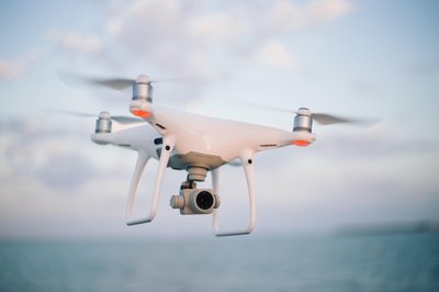
A remote sensing (RS) platform consisting of a remote-controlled aerial vehicle (RAV) can be used to monitor crop, environmental conditions, and productivity in agricultural areas. However, the current methods for the calibration of RAV-acquired images are cumbersome. Thus, a calibration method must be incorporated into RAV RS systems for practical and advanced applications. Here, we aimed to develop a standalone RAV RS-based calibration system without the need for calibration tarpaulins (tarps) by quantifying the sensor responses of a multispectral camera, which varies with light intensities. To develop the standalone RAV-based RS calibration system, we used a quadcopter with four propellers, with a rotor-to-rotor length of 46 cm and height of 25 cm. The quadcopter equipped with a multispectral camera with green, red, and near-infrared filters was used to acquire spectral images for formulating the RAV RS-based standardization system. To perform the calibration study process, libraries of sensor responses were constructed using pseudo-invariant tarps according to the light intensities to determine the relationship equations between the two factors. The calibrated images were then validated using the reflectance measured in crop fields. Finally, we evaluated the outcomes of the formulated RAV RS-based calibration system. The results of this study suggest that the standalone RAV RS system would be helpful in the processing of RAV RS-acquired images.
Related Topics


- Type
- article
- Language
- en
- Landing Page
- https://doi.org/10.3390/rs15051408
- https://www.mdpi.com/2072-4292/15/5/1408/pdf?version=1677751254
- OA Status
- gold
- Cited By
- 9
- References
- 36
- Related Works
- 10
- OpenAlex ID
- https://openalex.org/W4323044471
Raw OpenAlex JSON
- OpenAlex ID
-
https://openalex.org/W4323044471Canonical identifier for this work in OpenAlex
- DOI
-
https://doi.org/10.3390/rs15051408Digital Object Identifier
- Title
-
Development of a Radiometric Calibration Method for Multispectral Images of Croplands Obtained with a Remote-Controlled Aerial SystemWork title
- Type
-
articleOpenAlex work type
- Language
-
enPrimary language
- Publication year
-
2023Year of publication
- Publication date
-
2023-03-02Full publication date if available
- Authors
-
Taehwan Shin, Seungtaek Jeong, Jonghan KoList of authors in order
- Landing page
-
https://doi.org/10.3390/rs15051408Publisher landing page
- PDF URL
-
https://www.mdpi.com/2072-4292/15/5/1408/pdf?version=1677751254Direct link to full text PDF
- Open access
-
YesWhether a free full text is available
- OA status
-
goldOpen access status per OpenAlex
- OA URL
-
https://www.mdpi.com/2072-4292/15/5/1408/pdf?version=1677751254Direct OA link when available
- Concepts
-
Quadcopter, Remote sensing, Multispectral image, Calibration, Computer science, Environmental science, Computer vision, Artificial intelligence, Geology, Mathematics, Engineering, Statistics, Aerospace engineeringTop concepts (fields/topics) attached by OpenAlex
- Cited by
-
9Total citation count in OpenAlex
- Citations by year (recent)
-
2025: 2, 2024: 5, 2023: 2Per-year citation counts (last 5 years)
- References (count)
-
36Number of works referenced by this work
- Related works (count)
-
10Other works algorithmically related by OpenAlex
Full payload
| id | https://openalex.org/W4323044471 |
|---|---|
| doi | https://doi.org/10.3390/rs15051408 |
| ids.doi | https://doi.org/10.3390/rs15051408 |
| ids.openalex | https://openalex.org/W4323044471 |
| fwci | 2.72257414 |
| type | article |
| title | Development of a Radiometric Calibration Method for Multispectral Images of Croplands Obtained with a Remote-Controlled Aerial System |
| awards[0].id | https://openalex.org/G4299427030 |
| awards[0].funder_id | https://openalex.org/F4320322120 |
| awards[0].display_name | |
| awards[0].funder_award_id | NRF-2021R1A2C2004459 |
| awards[0].funder_display_name | National Research Foundation of Korea |
| biblio.issue | 5 |
| biblio.volume | 15 |
| biblio.last_page | 1408 |
| biblio.first_page | 1408 |
| topics[0].id | https://openalex.org/T10111 |
| topics[0].field.id | https://openalex.org/fields/23 |
| topics[0].field.display_name | Environmental Science |
| topics[0].score | 0.9955999851226807 |
| topics[0].domain.id | https://openalex.org/domains/3 |
| topics[0].domain.display_name | Physical Sciences |
| topics[0].subfield.id | https://openalex.org/subfields/2303 |
| topics[0].subfield.display_name | Ecology |
| topics[0].display_name | Remote Sensing in Agriculture |
| topics[1].id | https://openalex.org/T10616 |
| topics[1].field.id | https://openalex.org/fields/11 |
| topics[1].field.display_name | Agricultural and Biological Sciences |
| topics[1].score | 0.9760000109672546 |
| topics[1].domain.id | https://openalex.org/domains/1 |
| topics[1].domain.display_name | Life Sciences |
| topics[1].subfield.id | https://openalex.org/subfields/1110 |
| topics[1].subfield.display_name | Plant Science |
| topics[1].display_name | Smart Agriculture and AI |
| topics[2].id | https://openalex.org/T13890 |
| topics[2].field.id | https://openalex.org/fields/19 |
| topics[2].field.display_name | Earth and Planetary Sciences |
| topics[2].score | 0.9638000130653381 |
| topics[2].domain.id | https://openalex.org/domains/3 |
| topics[2].domain.display_name | Physical Sciences |
| topics[2].subfield.id | https://openalex.org/subfields/1902 |
| topics[2].subfield.display_name | Atmospheric Science |
| topics[2].display_name | Remote Sensing and Land Use |
| funders[0].id | https://openalex.org/F4320322120 |
| funders[0].ror | https://ror.org/013aysd81 |
| funders[0].display_name | National Research Foundation of Korea |
| is_xpac | False |
| apc_list.value | 2500 |
| apc_list.currency | CHF |
| apc_list.value_usd | 2707 |
| apc_paid.value | 2500 |
| apc_paid.currency | CHF |
| apc_paid.value_usd | 2707 |
| concepts[0].id | https://openalex.org/C2779199153 |
| concepts[0].level | 2 |
| concepts[0].score | 0.8673852682113647 |
| concepts[0].wikidata | https://www.wikidata.org/wiki/Q43965 |
| concepts[0].display_name | Quadcopter |
| concepts[1].id | https://openalex.org/C62649853 |
| concepts[1].level | 1 |
| concepts[1].score | 0.8072255253791809 |
| concepts[1].wikidata | https://www.wikidata.org/wiki/Q199687 |
| concepts[1].display_name | Remote sensing |
| concepts[2].id | https://openalex.org/C173163844 |
| concepts[2].level | 2 |
| concepts[2].score | 0.7999705672264099 |
| concepts[2].wikidata | https://www.wikidata.org/wiki/Q1761440 |
| concepts[2].display_name | Multispectral image |
| concepts[3].id | https://openalex.org/C165838908 |
| concepts[3].level | 2 |
| concepts[3].score | 0.7123562693595886 |
| concepts[3].wikidata | https://www.wikidata.org/wiki/Q736777 |
| concepts[3].display_name | Calibration |
| concepts[4].id | https://openalex.org/C41008148 |
| concepts[4].level | 0 |
| concepts[4].score | 0.5813465118408203 |
| concepts[4].wikidata | https://www.wikidata.org/wiki/Q21198 |
| concepts[4].display_name | Computer science |
| concepts[5].id | https://openalex.org/C39432304 |
| concepts[5].level | 0 |
| concepts[5].score | 0.43024227023124695 |
| concepts[5].wikidata | https://www.wikidata.org/wiki/Q188847 |
| concepts[5].display_name | Environmental science |
| concepts[6].id | https://openalex.org/C31972630 |
| concepts[6].level | 1 |
| concepts[6].score | 0.41493937373161316 |
| concepts[6].wikidata | https://www.wikidata.org/wiki/Q844240 |
| concepts[6].display_name | Computer vision |
| concepts[7].id | https://openalex.org/C154945302 |
| concepts[7].level | 1 |
| concepts[7].score | 0.3981744647026062 |
| concepts[7].wikidata | https://www.wikidata.org/wiki/Q11660 |
| concepts[7].display_name | Artificial intelligence |
| concepts[8].id | https://openalex.org/C127313418 |
| concepts[8].level | 0 |
| concepts[8].score | 0.2265489399433136 |
| concepts[8].wikidata | https://www.wikidata.org/wiki/Q1069 |
| concepts[8].display_name | Geology |
| concepts[9].id | https://openalex.org/C33923547 |
| concepts[9].level | 0 |
| concepts[9].score | 0.11052024364471436 |
| concepts[9].wikidata | https://www.wikidata.org/wiki/Q395 |
| concepts[9].display_name | Mathematics |
| concepts[10].id | https://openalex.org/C127413603 |
| concepts[10].level | 0 |
| concepts[10].score | 0.07730421423912048 |
| concepts[10].wikidata | https://www.wikidata.org/wiki/Q11023 |
| concepts[10].display_name | Engineering |
| concepts[11].id | https://openalex.org/C105795698 |
| concepts[11].level | 1 |
| concepts[11].score | 0.0 |
| concepts[11].wikidata | https://www.wikidata.org/wiki/Q12483 |
| concepts[11].display_name | Statistics |
| concepts[12].id | https://openalex.org/C146978453 |
| concepts[12].level | 1 |
| concepts[12].score | 0.0 |
| concepts[12].wikidata | https://www.wikidata.org/wiki/Q3798668 |
| concepts[12].display_name | Aerospace engineering |
| keywords[0].id | https://openalex.org/keywords/quadcopter |
| keywords[0].score | 0.8673852682113647 |
| keywords[0].display_name | Quadcopter |
| keywords[1].id | https://openalex.org/keywords/remote-sensing |
| keywords[1].score | 0.8072255253791809 |
| keywords[1].display_name | Remote sensing |
| keywords[2].id | https://openalex.org/keywords/multispectral-image |
| keywords[2].score | 0.7999705672264099 |
| keywords[2].display_name | Multispectral image |
| keywords[3].id | https://openalex.org/keywords/calibration |
| keywords[3].score | 0.7123562693595886 |
| keywords[3].display_name | Calibration |
| keywords[4].id | https://openalex.org/keywords/computer-science |
| keywords[4].score | 0.5813465118408203 |
| keywords[4].display_name | Computer science |
| keywords[5].id | https://openalex.org/keywords/environmental-science |
| keywords[5].score | 0.43024227023124695 |
| keywords[5].display_name | Environmental science |
| keywords[6].id | https://openalex.org/keywords/computer-vision |
| keywords[6].score | 0.41493937373161316 |
| keywords[6].display_name | Computer vision |
| keywords[7].id | https://openalex.org/keywords/artificial-intelligence |
| keywords[7].score | 0.3981744647026062 |
| keywords[7].display_name | Artificial intelligence |
| keywords[8].id | https://openalex.org/keywords/geology |
| keywords[8].score | 0.2265489399433136 |
| keywords[8].display_name | Geology |
| keywords[9].id | https://openalex.org/keywords/mathematics |
| keywords[9].score | 0.11052024364471436 |
| keywords[9].display_name | Mathematics |
| keywords[10].id | https://openalex.org/keywords/engineering |
| keywords[10].score | 0.07730421423912048 |
| keywords[10].display_name | Engineering |
| language | en |
| locations[0].id | doi:10.3390/rs15051408 |
| locations[0].is_oa | True |
| locations[0].source.id | https://openalex.org/S43295729 |
| locations[0].source.issn | 2072-4292 |
| locations[0].source.type | journal |
| locations[0].source.is_oa | True |
| locations[0].source.issn_l | 2072-4292 |
| locations[0].source.is_core | True |
| locations[0].source.is_in_doaj | True |
| locations[0].source.display_name | Remote Sensing |
| locations[0].source.host_organization | https://openalex.org/P4310310987 |
| locations[0].source.host_organization_name | Multidisciplinary Digital Publishing Institute |
| locations[0].source.host_organization_lineage | https://openalex.org/P4310310987 |
| locations[0].source.host_organization_lineage_names | Multidisciplinary Digital Publishing Institute |
| locations[0].license | cc-by |
| locations[0].pdf_url | https://www.mdpi.com/2072-4292/15/5/1408/pdf?version=1677751254 |
| locations[0].version | publishedVersion |
| locations[0].raw_type | journal-article |
| locations[0].license_id | https://openalex.org/licenses/cc-by |
| locations[0].is_accepted | True |
| locations[0].is_published | True |
| locations[0].raw_source_name | Remote Sensing |
| locations[0].landing_page_url | https://doi.org/10.3390/rs15051408 |
| locations[1].id | pmh:oai:doaj.org/article:be98939182bb4fa28d77c4f547590488 |
| locations[1].is_oa | False |
| locations[1].source.id | https://openalex.org/S4306401280 |
| locations[1].source.issn | |
| locations[1].source.type | repository |
| locations[1].source.is_oa | False |
| locations[1].source.issn_l | |
| locations[1].source.is_core | False |
| locations[1].source.is_in_doaj | False |
| locations[1].source.display_name | DOAJ (DOAJ: Directory of Open Access Journals) |
| locations[1].source.host_organization | |
| locations[1].source.host_organization_name | |
| locations[1].license | |
| locations[1].pdf_url | |
| locations[1].version | submittedVersion |
| locations[1].raw_type | article |
| locations[1].license_id | |
| locations[1].is_accepted | False |
| locations[1].is_published | False |
| locations[1].raw_source_name | Remote Sensing, Vol 15, Iss 5, p 1408 (2023) |
| locations[1].landing_page_url | https://doaj.org/article/be98939182bb4fa28d77c4f547590488 |
| locations[2].id | pmh:oai:mdpi.com:/2072-4292/15/5/1408/ |
| locations[2].is_oa | True |
| locations[2].source.id | https://openalex.org/S4306400947 |
| locations[2].source.issn | |
| locations[2].source.type | repository |
| locations[2].source.is_oa | True |
| locations[2].source.issn_l | |
| locations[2].source.is_core | False |
| locations[2].source.is_in_doaj | False |
| locations[2].source.display_name | MDPI (MDPI AG) |
| locations[2].source.host_organization | https://openalex.org/I4210097602 |
| locations[2].source.host_organization_name | Multidisciplinary Digital Publishing Institute (Switzerland) |
| locations[2].source.host_organization_lineage | https://openalex.org/I4210097602 |
| locations[2].license | cc-by |
| locations[2].pdf_url | |
| locations[2].version | submittedVersion |
| locations[2].raw_type | Text |
| locations[2].license_id | https://openalex.org/licenses/cc-by |
| locations[2].is_accepted | False |
| locations[2].is_published | False |
| locations[2].raw_source_name | Remote Sensing |
| locations[2].landing_page_url | https://dx.doi.org/10.3390/rs15051408 |
| indexed_in | crossref, doaj |
| authorships[0].author.id | https://openalex.org/A5057561870 |
| authorships[0].author.orcid | https://orcid.org/0000-0003-1401-8837 |
| authorships[0].author.display_name | Taehwan Shin |
| authorships[0].countries | KR |
| authorships[0].affiliations[0].institution_ids | https://openalex.org/I111277659 |
| authorships[0].affiliations[0].raw_affiliation_string | Department of Applied Plant Science, Chonnam National University, Gwangju 61186, Republic of Korea |
| authorships[0].institutions[0].id | https://openalex.org/I111277659 |
| authorships[0].institutions[0].ror | https://ror.org/05kzjxq56 |
| authorships[0].institutions[0].type | education |
| authorships[0].institutions[0].lineage | https://openalex.org/I111277659 |
| authorships[0].institutions[0].country_code | KR |
| authorships[0].institutions[0].display_name | Chonnam National University |
| authorships[0].author_position | first |
| authorships[0].raw_author_name | Taehwan Shin |
| authorships[0].is_corresponding | False |
| authorships[0].raw_affiliation_strings | Department of Applied Plant Science, Chonnam National University, Gwangju 61186, Republic of Korea |
| authorships[1].author.id | https://openalex.org/A5009791117 |
| authorships[1].author.orcid | https://orcid.org/0000-0003-2989-1364 |
| authorships[1].author.display_name | Seungtaek Jeong |
| authorships[1].countries | KR |
| authorships[1].affiliations[0].institution_ids | https://openalex.org/I2800747041 |
| authorships[1].affiliations[0].raw_affiliation_string | Satellite Application Division, Korea Aerospace Research Institute, Daejeon 34133, Republic of Korea |
| authorships[1].institutions[0].id | https://openalex.org/I2800747041 |
| authorships[1].institutions[0].ror | https://ror.org/037pqnq23 |
| authorships[1].institutions[0].type | government |
| authorships[1].institutions[0].lineage | https://openalex.org/I2800747041, https://openalex.org/I2801339556, https://openalex.org/I4387152098, https://openalex.org/I4412460384 |
| authorships[1].institutions[0].country_code | KR |
| authorships[1].institutions[0].display_name | Korea Aerospace Research Institute |
| authorships[1].author_position | middle |
| authorships[1].raw_author_name | Seungtaek Jeong |
| authorships[1].is_corresponding | False |
| authorships[1].raw_affiliation_strings | Satellite Application Division, Korea Aerospace Research Institute, Daejeon 34133, Republic of Korea |
| authorships[2].author.id | https://openalex.org/A5048484343 |
| authorships[2].author.orcid | https://orcid.org/0000-0001-7974-3808 |
| authorships[2].author.display_name | Jonghan Ko |
| authorships[2].countries | KR |
| authorships[2].affiliations[0].institution_ids | https://openalex.org/I111277659 |
| authorships[2].affiliations[0].raw_affiliation_string | Department of Applied Plant Science, Chonnam National University, Gwangju 61186, Republic of Korea |
| authorships[2].institutions[0].id | https://openalex.org/I111277659 |
| authorships[2].institutions[0].ror | https://ror.org/05kzjxq56 |
| authorships[2].institutions[0].type | education |
| authorships[2].institutions[0].lineage | https://openalex.org/I111277659 |
| authorships[2].institutions[0].country_code | KR |
| authorships[2].institutions[0].display_name | Chonnam National University |
| authorships[2].author_position | last |
| authorships[2].raw_author_name | Jonghan Ko |
| authorships[2].is_corresponding | True |
| authorships[2].raw_affiliation_strings | Department of Applied Plant Science, Chonnam National University, Gwangju 61186, Republic of Korea |
| has_content.pdf | True |
| has_content.grobid_xml | True |
| is_paratext | False |
| open_access.is_oa | True |
| open_access.oa_url | https://www.mdpi.com/2072-4292/15/5/1408/pdf?version=1677751254 |
| open_access.oa_status | gold |
| open_access.any_repository_has_fulltext | False |
| created_date | 2025-10-10T00:00:00 |
| display_name | Development of a Radiometric Calibration Method for Multispectral Images of Croplands Obtained with a Remote-Controlled Aerial System |
| has_fulltext | False |
| is_retracted | False |
| updated_date | 2025-11-06T03:46:38.306776 |
| primary_topic.id | https://openalex.org/T10111 |
| primary_topic.field.id | https://openalex.org/fields/23 |
| primary_topic.field.display_name | Environmental Science |
| primary_topic.score | 0.9955999851226807 |
| primary_topic.domain.id | https://openalex.org/domains/3 |
| primary_topic.domain.display_name | Physical Sciences |
| primary_topic.subfield.id | https://openalex.org/subfields/2303 |
| primary_topic.subfield.display_name | Ecology |
| primary_topic.display_name | Remote Sensing in Agriculture |
| related_works | https://openalex.org/W4293056360, https://openalex.org/W4386804942, https://openalex.org/W2966028239, https://openalex.org/W2526240748, https://openalex.org/W2909947097, https://openalex.org/W2264340699, https://openalex.org/W4286283119, https://openalex.org/W2890534329, https://openalex.org/W4293734307, https://openalex.org/W2462474087 |
| cited_by_count | 9 |
| counts_by_year[0].year | 2025 |
| counts_by_year[0].cited_by_count | 2 |
| counts_by_year[1].year | 2024 |
| counts_by_year[1].cited_by_count | 5 |
| counts_by_year[2].year | 2023 |
| counts_by_year[2].cited_by_count | 2 |
| locations_count | 3 |
| best_oa_location.id | doi:10.3390/rs15051408 |
| best_oa_location.is_oa | True |
| best_oa_location.source.id | https://openalex.org/S43295729 |
| best_oa_location.source.issn | 2072-4292 |
| best_oa_location.source.type | journal |
| best_oa_location.source.is_oa | True |
| best_oa_location.source.issn_l | 2072-4292 |
| best_oa_location.source.is_core | True |
| best_oa_location.source.is_in_doaj | True |
| best_oa_location.source.display_name | Remote Sensing |
| best_oa_location.source.host_organization | https://openalex.org/P4310310987 |
| best_oa_location.source.host_organization_name | Multidisciplinary Digital Publishing Institute |
| best_oa_location.source.host_organization_lineage | https://openalex.org/P4310310987 |
| best_oa_location.source.host_organization_lineage_names | Multidisciplinary Digital Publishing Institute |
| best_oa_location.license | cc-by |
| best_oa_location.pdf_url | https://www.mdpi.com/2072-4292/15/5/1408/pdf?version=1677751254 |
| best_oa_location.version | publishedVersion |
| best_oa_location.raw_type | journal-article |
| best_oa_location.license_id | https://openalex.org/licenses/cc-by |
| best_oa_location.is_accepted | True |
| best_oa_location.is_published | True |
| best_oa_location.raw_source_name | Remote Sensing |
| best_oa_location.landing_page_url | https://doi.org/10.3390/rs15051408 |
| primary_location.id | doi:10.3390/rs15051408 |
| primary_location.is_oa | True |
| primary_location.source.id | https://openalex.org/S43295729 |
| primary_location.source.issn | 2072-4292 |
| primary_location.source.type | journal |
| primary_location.source.is_oa | True |
| primary_location.source.issn_l | 2072-4292 |
| primary_location.source.is_core | True |
| primary_location.source.is_in_doaj | True |
| primary_location.source.display_name | Remote Sensing |
| primary_location.source.host_organization | https://openalex.org/P4310310987 |
| primary_location.source.host_organization_name | Multidisciplinary Digital Publishing Institute |
| primary_location.source.host_organization_lineage | https://openalex.org/P4310310987 |
| primary_location.source.host_organization_lineage_names | Multidisciplinary Digital Publishing Institute |
| primary_location.license | cc-by |
| primary_location.pdf_url | https://www.mdpi.com/2072-4292/15/5/1408/pdf?version=1677751254 |
| primary_location.version | publishedVersion |
| primary_location.raw_type | journal-article |
| primary_location.license_id | https://openalex.org/licenses/cc-by |
| primary_location.is_accepted | True |
| primary_location.is_published | True |
| primary_location.raw_source_name | Remote Sensing |
| primary_location.landing_page_url | https://doi.org/10.3390/rs15051408 |
| publication_date | 2023-03-02 |
| publication_year | 2023 |
| referenced_works | https://openalex.org/W2151499786, https://openalex.org/W2783475900, https://openalex.org/W1969234587, https://openalex.org/W2843415492, https://openalex.org/W2139294397, https://openalex.org/W2040403200, https://openalex.org/W3136436158, https://openalex.org/W3019576236, https://openalex.org/W2041148025, https://openalex.org/W2145982493, https://openalex.org/W2979531829, https://openalex.org/W6684667285, https://openalex.org/W2913373042, https://openalex.org/W2910791660, https://openalex.org/W2127050250, https://openalex.org/W2069209512, https://openalex.org/W2410708347, https://openalex.org/W2912130932, https://openalex.org/W6842105208, https://openalex.org/W3113957078, https://openalex.org/W3136619453, https://openalex.org/W3118298788, https://openalex.org/W3028167980, https://openalex.org/W2947820157, https://openalex.org/W2811208991, https://openalex.org/W2904698365, https://openalex.org/W2021819389, https://openalex.org/W2770044616, https://openalex.org/W3125107568, https://openalex.org/W3196122589, https://openalex.org/W1797164778, https://openalex.org/W2039409148, https://openalex.org/W2045297017, https://openalex.org/W1980467157, https://openalex.org/W2169023243, https://openalex.org/W4293118081 |
| referenced_works_count | 36 |
| abstract_inverted_index.A | 0 |
| abstract_inverted_index.a | 7, 38, 58, 77, 95, 101, 116 |
| abstract_inverted_index.25 | 110 |
| abstract_inverted_index.46 | 105 |
| abstract_inverted_index.RS | 46, 90, 202 |
| abstract_inverted_index.To | 85, 138 |
| abstract_inverted_index.be | 13, 42, 205 |
| abstract_inverted_index.by | 71 |
| abstract_inverted_index.cm | 106 |
| abstract_inverted_index.in | 22, 177, 207 |
| abstract_inverted_index.of | 6, 32, 76, 104, 109, 145, 185, 194, 210 |
| abstract_inverted_index.to | 15, 56, 127, 154, 158 |
| abstract_inverted_index.we | 54, 93, 181 |
| abstract_inverted_index.RAV | 45, 60, 134, 188, 201, 211 |
| abstract_inverted_index.The | 112, 167, 192 |
| abstract_inverted_index.and | 20, 50, 107, 122 |
| abstract_inverted_index.are | 35 |
| abstract_inverted_index.can | 12 |
| abstract_inverted_index.cm. | 111 |
| abstract_inverted_index.for | 29, 48, 67, 131 |
| abstract_inverted_index.the | 26, 30, 65, 73, 87, 133, 140, 155, 160, 164, 174, 183, 186, 199, 208 |
| abstract_inverted_index.two | 165 |
| abstract_inverted_index.was | 125 |
| abstract_inverted_index.(RS) | 3 |
| abstract_inverted_index.crop | 178 |
| abstract_inverted_index.four | 98 |
| abstract_inverted_index.into | 44 |
| abstract_inverted_index.must | 41 |
| abstract_inverted_index.need | 66 |
| abstract_inverted_index.red, | 121 |
| abstract_inverted_index.that | 198 |
| abstract_inverted_index.then | 171 |
| abstract_inverted_index.this | 195 |
| abstract_inverted_index.used | 14, 94, 126 |
| abstract_inverted_index.were | 148, 170 |
| abstract_inverted_index.with | 82, 97, 100, 115, 119 |
| abstract_inverted_index.(RAV) | 11 |
| abstract_inverted_index.Here, | 53 |
| abstract_inverted_index.Thus, | 37 |
| abstract_inverted_index.aimed | 55 |
| abstract_inverted_index.crop, | 17 |
| abstract_inverted_index.light | 83, 156 |
| abstract_inverted_index.study | 142, 196 |
| abstract_inverted_index.tarps | 152 |
| abstract_inverted_index.using | 150, 173 |
| abstract_inverted_index.which | 80 |
| abstract_inverted_index.would | 204 |
| abstract_inverted_index.aerial | 9 |
| abstract_inverted_index.areas. | 24 |
| abstract_inverted_index.camera | 118 |
| abstract_inverted_index.green, | 120 |
| abstract_inverted_index.height | 108 |
| abstract_inverted_index.images | 34, 130, 169 |
| abstract_inverted_index.length | 103 |
| abstract_inverted_index.method | 40 |
| abstract_inverted_index.remote | 1 |
| abstract_inverted_index.sensor | 74, 146 |
| abstract_inverted_index.system | 63, 203 |
| abstract_inverted_index.varies | 81 |
| abstract_inverted_index.(tarps) | 70 |
| abstract_inverted_index.acquire | 128 |
| abstract_inverted_index.between | 163 |
| abstract_inverted_index.camera, | 79 |
| abstract_inverted_index.current | 27 |
| abstract_inverted_index.develop | 57, 86 |
| abstract_inverted_index.fields. | 179 |
| abstract_inverted_index.filters | 124 |
| abstract_inverted_index.helpful | 206 |
| abstract_inverted_index.images. | 213 |
| abstract_inverted_index.methods | 28 |
| abstract_inverted_index.monitor | 16 |
| abstract_inverted_index.perform | 139 |
| abstract_inverted_index.results | 193 |
| abstract_inverted_index.sensing | 2 |
| abstract_inverted_index.suggest | 197 |
| abstract_inverted_index.system, | 92 |
| abstract_inverted_index.system. | 137, 191 |
| abstract_inverted_index.systems | 47 |
| abstract_inverted_index.vehicle | 10 |
| abstract_inverted_index.without | 64 |
| abstract_inverted_index.Finally, | 180 |
| abstract_inverted_index.However, | 25 |
| abstract_inverted_index.RS-based | 61, 135, 189 |
| abstract_inverted_index.advanced | 51 |
| abstract_inverted_index.equipped | 114 |
| abstract_inverted_index.factors. | 166 |
| abstract_inverted_index.measured | 176 |
| abstract_inverted_index.outcomes | 184 |
| abstract_inverted_index.platform | 4 |
| abstract_inverted_index.process, | 143 |
| abstract_inverted_index.spectral | 129 |
| abstract_inverted_index.RAV-based | 89 |
| abstract_inverted_index.according | 153 |
| abstract_inverted_index.determine | 159 |
| abstract_inverted_index.equations | 162 |
| abstract_inverted_index.evaluated | 182 |
| abstract_inverted_index.libraries | 144 |
| abstract_inverted_index.practical | 49 |
| abstract_inverted_index.responses | 75, 147 |
| abstract_inverted_index.validated | 172 |
| abstract_inverted_index.calibrated | 168 |
| abstract_inverted_index.consisting | 5 |
| abstract_inverted_index.formulated | 187 |
| abstract_inverted_index.processing | 209 |
| abstract_inverted_index.quadcopter | 96, 113 |
| abstract_inverted_index.standalone | 59, 88, 200 |
| abstract_inverted_index.tarpaulins | 69 |
| abstract_inverted_index.RS-acquired | 212 |
| abstract_inverted_index.calibration | 31, 39, 62, 68, 91, 141, 190 |
| abstract_inverted_index.conditions, | 19 |
| abstract_inverted_index.constructed | 149 |
| abstract_inverted_index.cumbersome. | 36 |
| abstract_inverted_index.formulating | 132 |
| abstract_inverted_index.intensities | 157 |
| abstract_inverted_index.propellers, | 99 |
| abstract_inverted_index.quantifying | 72 |
| abstract_inverted_index.reflectance | 175 |
| abstract_inverted_index.RAV-acquired | 33 |
| abstract_inverted_index.agricultural | 23 |
| abstract_inverted_index.incorporated | 43 |
| abstract_inverted_index.intensities. | 84 |
| abstract_inverted_index.productivity | 21 |
| abstract_inverted_index.relationship | 161 |
| abstract_inverted_index.applications. | 52 |
| abstract_inverted_index.environmental | 18 |
| abstract_inverted_index.multispectral | 78, 117 |
| abstract_inverted_index.near-infrared | 123 |
| abstract_inverted_index.rotor-to-rotor | 102 |
| abstract_inverted_index.standardization | 136 |
| abstract_inverted_index.pseudo-invariant | 151 |
| abstract_inverted_index.remote-controlled | 8 |
| cited_by_percentile_year.max | 98 |
| cited_by_percentile_year.min | 94 |
| corresponding_author_ids | https://openalex.org/A5048484343 |
| countries_distinct_count | 1 |
| institutions_distinct_count | 3 |
| corresponding_institution_ids | https://openalex.org/I111277659 |
| sustainable_development_goals[0].id | https://metadata.un.org/sdg/2 |
| sustainable_development_goals[0].score | 0.7799999713897705 |
| sustainable_development_goals[0].display_name | Zero hunger |
| citation_normalized_percentile.value | 0.88553333 |
| citation_normalized_percentile.is_in_top_1_percent | False |
| citation_normalized_percentile.is_in_top_10_percent | False |