Multi-Temporal Satellite Interferometry for Fast-Motion Detection: An Application to Salt Solution Mining Article Swipe
 YOU?
·
· 2020
· Open Access
·
· DOI: https://doi.org/10.3390/rs12233919
YOU?
·
· 2020
· Open Access
·
· DOI: https://doi.org/10.3390/rs12233919
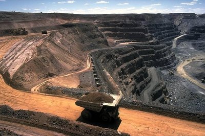
Underground mining is one of the human activities with the highest impact in terms of induced ground motion. The excavation of the mining levels creates pillars, rooms and cavities that can evolve in chimney collapses and sinkholes. This is a major threat where the mining activity is carried out in an urban context. Thus, there is a clear need for tools and instruments able to precisely quantify mining-induced deformation. Topographic measurements certainly offer very high spatial accuracy and temporal repeatability, but they lack in spatial distribution of measurement points. In the past decades, Multi-Temporal Satellite Interferometry (MTInSAR) has become one of the most reliable techniques for monitoring ground motion, including mining-induced deformation. Although with well-known limitations when high deformation rates and frequently changing land surfaces are involved, MTInSAR has been exploited to evaluate the surface motion in several mining area worldwide. In this paper, a detailed scale MTInSAR approach was designed to characterize ground deformation in the salt solution mining area of Saline di Volterra (Tuscany Region, central Italy). This mining activity has a relevant environmental impact, depleting the water resource and inducing ground motion; sinkholes are a common consequence. The MTInSAR processing approach is based on the direct integration of interferograms derived from Sentinel-1 images and on the phase splitting between low (LF) and high (HF) frequency components. Phase unwrapping is performed for the LF and HF components on a set of points selected through a “triplets closure” method. The final deformation map is derived by combining again the components to avoid error accumulation and by applying a classical atmospheric phase filtering to remove the remaining low frequency signal. The results obtained reveal the presence of several subsidence bowls, sometimes corresponding to sinkholes formed in the recent past. Very high deformation rates, up to −250 mm/yr, and time series with clear trend changes are registered. In addition, the spatial and temporal distribution of velocities and time series is analyzed, with a focus on the correlation with sinkhole occurrence.
Related Topics


- Type
- article
- Language
- en
- Landing Page
- https://doi.org/10.3390/rs12233919
- https://www.mdpi.com/2072-4292/12/23/3919/pdf?version=1607585848
- OA Status
- gold
- Cited By
- 15
- References
- 60
- Related Works
- 10
- OpenAlex ID
- https://openalex.org/W3109806394
Raw OpenAlex JSON
- OpenAlex ID
-
https://openalex.org/W3109806394Canonical identifier for this work in OpenAlex
- DOI
-
https://doi.org/10.3390/rs12233919Digital Object Identifier
- Title
-
Multi-Temporal Satellite Interferometry for Fast-Motion Detection: An Application to Salt Solution MiningWork title
- Type
-
articleOpenAlex work type
- Language
-
enPrimary language
- Publication year
-
2020Year of publication
- Publication date
-
2020-11-29Full publication date if available
- Authors
-
Pier Lorenzo Solari, Roberto Montalti, Anna Barra, Oriol Monserrat, Silvia Bianchini, Michele CrosettoList of authors in order
- Landing page
-
https://doi.org/10.3390/rs12233919Publisher landing page
- PDF URL
-
https://www.mdpi.com/2072-4292/12/23/3919/pdf?version=1607585848Direct link to full text PDF
- Open access
-
YesWhether a free full text is available
- OA status
-
goldOpen access status per OpenAlex
- OA URL
-
https://www.mdpi.com/2072-4292/12/23/3919/pdf?version=1607585848Direct OA link when available
- Concepts
-
Sinkhole, Interferometry, Satellite, Context (archaeology), Remote sensing, Geology, Deformation (meteorology), Scale (ratio), Computer science, Mining engineering, Cartography, Geography, Aerospace engineering, Paleontology, Oceanography, Astronomy, Physics, Engineering, KarstTop concepts (fields/topics) attached by OpenAlex
- Cited by
-
15Total citation count in OpenAlex
- Citations by year (recent)
-
2025: 1, 2024: 6, 2023: 1, 2022: 6, 2021: 1Per-year citation counts (last 5 years)
- References (count)
-
60Number of works referenced by this work
- Related works (count)
-
10Other works algorithmically related by OpenAlex
Full payload
| id | https://openalex.org/W3109806394 |
|---|---|
| doi | https://doi.org/10.3390/rs12233919 |
| ids.doi | https://doi.org/10.3390/rs12233919 |
| ids.mag | 3109806394 |
| ids.openalex | https://openalex.org/W3109806394 |
| fwci | 2.38928496 |
| type | article |
| title | Multi-Temporal Satellite Interferometry for Fast-Motion Detection: An Application to Salt Solution Mining |
| biblio.issue | 23 |
| biblio.volume | 12 |
| biblio.last_page | 3919 |
| biblio.first_page | 3919 |
| topics[0].id | https://openalex.org/T10801 |
| topics[0].field.id | https://openalex.org/fields/22 |
| topics[0].field.display_name | Engineering |
| topics[0].score | 0.9995999932289124 |
| topics[0].domain.id | https://openalex.org/domains/3 |
| topics[0].domain.display_name | Physical Sciences |
| topics[0].subfield.id | https://openalex.org/subfields/2202 |
| topics[0].subfield.display_name | Aerospace Engineering |
| topics[0].display_name | Synthetic Aperture Radar (SAR) Applications and Techniques |
| topics[1].id | https://openalex.org/T10535 |
| topics[1].field.id | https://openalex.org/fields/23 |
| topics[1].field.display_name | Environmental Science |
| topics[1].score | 0.9865000247955322 |
| topics[1].domain.id | https://openalex.org/domains/3 |
| topics[1].domain.display_name | Physical Sciences |
| topics[1].subfield.id | https://openalex.org/subfields/2308 |
| topics[1].subfield.display_name | Management, Monitoring, Policy and Law |
| topics[1].display_name | Landslides and related hazards |
| topics[2].id | https://openalex.org/T12083 |
| topics[2].field.id | https://openalex.org/fields/19 |
| topics[2].field.display_name | Earth and Planetary Sciences |
| topics[2].score | 0.9666000008583069 |
| topics[2].domain.id | https://openalex.org/domains/3 |
| topics[2].domain.display_name | Physical Sciences |
| topics[2].subfield.id | https://openalex.org/subfields/1904 |
| topics[2].subfield.display_name | Earth-Surface Processes |
| topics[2].display_name | Karst Systems and Hydrogeology |
| is_xpac | False |
| apc_list.value | 2500 |
| apc_list.currency | CHF |
| apc_list.value_usd | 2707 |
| apc_paid.value | 2500 |
| apc_paid.currency | CHF |
| apc_paid.value_usd | 2707 |
| concepts[0].id | https://openalex.org/C49223487 |
| concepts[0].level | 3 |
| concepts[0].score | 0.7297017574310303 |
| concepts[0].wikidata | https://www.wikidata.org/wiki/Q188734 |
| concepts[0].display_name | Sinkhole |
| concepts[1].id | https://openalex.org/C166689943 |
| concepts[1].level | 2 |
| concepts[1].score | 0.4969315826892853 |
| concepts[1].wikidata | https://www.wikidata.org/wiki/Q850283 |
| concepts[1].display_name | Interferometry |
| concepts[2].id | https://openalex.org/C19269812 |
| concepts[2].level | 2 |
| concepts[2].score | 0.4852285385131836 |
| concepts[2].wikidata | https://www.wikidata.org/wiki/Q26540 |
| concepts[2].display_name | Satellite |
| concepts[3].id | https://openalex.org/C2779343474 |
| concepts[3].level | 2 |
| concepts[3].score | 0.4800761342048645 |
| concepts[3].wikidata | https://www.wikidata.org/wiki/Q3109175 |
| concepts[3].display_name | Context (archaeology) |
| concepts[4].id | https://openalex.org/C62649853 |
| concepts[4].level | 1 |
| concepts[4].score | 0.47934871912002563 |
| concepts[4].wikidata | https://www.wikidata.org/wiki/Q199687 |
| concepts[4].display_name | Remote sensing |
| concepts[5].id | https://openalex.org/C127313418 |
| concepts[5].level | 0 |
| concepts[5].score | 0.47479552030563354 |
| concepts[5].wikidata | https://www.wikidata.org/wiki/Q1069 |
| concepts[5].display_name | Geology |
| concepts[6].id | https://openalex.org/C204366326 |
| concepts[6].level | 2 |
| concepts[6].score | 0.46494239568710327 |
| concepts[6].wikidata | https://www.wikidata.org/wiki/Q3027650 |
| concepts[6].display_name | Deformation (meteorology) |
| concepts[7].id | https://openalex.org/C2778755073 |
| concepts[7].level | 2 |
| concepts[7].score | 0.4414759576320648 |
| concepts[7].wikidata | https://www.wikidata.org/wiki/Q10858537 |
| concepts[7].display_name | Scale (ratio) |
| concepts[8].id | https://openalex.org/C41008148 |
| concepts[8].level | 0 |
| concepts[8].score | 0.3888605237007141 |
| concepts[8].wikidata | https://www.wikidata.org/wiki/Q21198 |
| concepts[8].display_name | Computer science |
| concepts[9].id | https://openalex.org/C16674752 |
| concepts[9].level | 1 |
| concepts[9].score | 0.38343048095703125 |
| concepts[9].wikidata | https://www.wikidata.org/wiki/Q1370637 |
| concepts[9].display_name | Mining engineering |
| concepts[10].id | https://openalex.org/C58640448 |
| concepts[10].level | 1 |
| concepts[10].score | 0.15262553095817566 |
| concepts[10].wikidata | https://www.wikidata.org/wiki/Q42515 |
| concepts[10].display_name | Cartography |
| concepts[11].id | https://openalex.org/C205649164 |
| concepts[11].level | 0 |
| concepts[11].score | 0.13546523451805115 |
| concepts[11].wikidata | https://www.wikidata.org/wiki/Q1071 |
| concepts[11].display_name | Geography |
| concepts[12].id | https://openalex.org/C146978453 |
| concepts[12].level | 1 |
| concepts[12].score | 0.0 |
| concepts[12].wikidata | https://www.wikidata.org/wiki/Q3798668 |
| concepts[12].display_name | Aerospace engineering |
| concepts[13].id | https://openalex.org/C151730666 |
| concepts[13].level | 1 |
| concepts[13].score | 0.0 |
| concepts[13].wikidata | https://www.wikidata.org/wiki/Q7205 |
| concepts[13].display_name | Paleontology |
| concepts[14].id | https://openalex.org/C111368507 |
| concepts[14].level | 1 |
| concepts[14].score | 0.0 |
| concepts[14].wikidata | https://www.wikidata.org/wiki/Q43518 |
| concepts[14].display_name | Oceanography |
| concepts[15].id | https://openalex.org/C1276947 |
| concepts[15].level | 1 |
| concepts[15].score | 0.0 |
| concepts[15].wikidata | https://www.wikidata.org/wiki/Q333 |
| concepts[15].display_name | Astronomy |
| concepts[16].id | https://openalex.org/C121332964 |
| concepts[16].level | 0 |
| concepts[16].score | 0.0 |
| concepts[16].wikidata | https://www.wikidata.org/wiki/Q413 |
| concepts[16].display_name | Physics |
| concepts[17].id | https://openalex.org/C127413603 |
| concepts[17].level | 0 |
| concepts[17].score | 0.0 |
| concepts[17].wikidata | https://www.wikidata.org/wiki/Q11023 |
| concepts[17].display_name | Engineering |
| concepts[18].id | https://openalex.org/C182348080 |
| concepts[18].level | 2 |
| concepts[18].score | 0.0 |
| concepts[18].wikidata | https://www.wikidata.org/wiki/Q16817 |
| concepts[18].display_name | Karst |
| keywords[0].id | https://openalex.org/keywords/sinkhole |
| keywords[0].score | 0.7297017574310303 |
| keywords[0].display_name | Sinkhole |
| keywords[1].id | https://openalex.org/keywords/interferometry |
| keywords[1].score | 0.4969315826892853 |
| keywords[1].display_name | Interferometry |
| keywords[2].id | https://openalex.org/keywords/satellite |
| keywords[2].score | 0.4852285385131836 |
| keywords[2].display_name | Satellite |
| keywords[3].id | https://openalex.org/keywords/context |
| keywords[3].score | 0.4800761342048645 |
| keywords[3].display_name | Context (archaeology) |
| keywords[4].id | https://openalex.org/keywords/remote-sensing |
| keywords[4].score | 0.47934871912002563 |
| keywords[4].display_name | Remote sensing |
| keywords[5].id | https://openalex.org/keywords/geology |
| keywords[5].score | 0.47479552030563354 |
| keywords[5].display_name | Geology |
| keywords[6].id | https://openalex.org/keywords/deformation |
| keywords[6].score | 0.46494239568710327 |
| keywords[6].display_name | Deformation (meteorology) |
| keywords[7].id | https://openalex.org/keywords/scale |
| keywords[7].score | 0.4414759576320648 |
| keywords[7].display_name | Scale (ratio) |
| keywords[8].id | https://openalex.org/keywords/computer-science |
| keywords[8].score | 0.3888605237007141 |
| keywords[8].display_name | Computer science |
| keywords[9].id | https://openalex.org/keywords/mining-engineering |
| keywords[9].score | 0.38343048095703125 |
| keywords[9].display_name | Mining engineering |
| keywords[10].id | https://openalex.org/keywords/cartography |
| keywords[10].score | 0.15262553095817566 |
| keywords[10].display_name | Cartography |
| keywords[11].id | https://openalex.org/keywords/geography |
| keywords[11].score | 0.13546523451805115 |
| keywords[11].display_name | Geography |
| language | en |
| locations[0].id | doi:10.3390/rs12233919 |
| locations[0].is_oa | True |
| locations[0].source.id | https://openalex.org/S43295729 |
| locations[0].source.issn | 2072-4292 |
| locations[0].source.type | journal |
| locations[0].source.is_oa | True |
| locations[0].source.issn_l | 2072-4292 |
| locations[0].source.is_core | True |
| locations[0].source.is_in_doaj | True |
| locations[0].source.display_name | Remote Sensing |
| locations[0].source.host_organization | https://openalex.org/P4310310987 |
| locations[0].source.host_organization_name | Multidisciplinary Digital Publishing Institute |
| locations[0].source.host_organization_lineage | https://openalex.org/P4310310987 |
| locations[0].source.host_organization_lineage_names | Multidisciplinary Digital Publishing Institute |
| locations[0].license | cc-by |
| locations[0].pdf_url | https://www.mdpi.com/2072-4292/12/23/3919/pdf?version=1607585848 |
| locations[0].version | publishedVersion |
| locations[0].raw_type | journal-article |
| locations[0].license_id | https://openalex.org/licenses/cc-by |
| locations[0].is_accepted | True |
| locations[0].is_published | True |
| locations[0].raw_source_name | Remote Sensing |
| locations[0].landing_page_url | https://doi.org/10.3390/rs12233919 |
| locations[1].id | pmh:oai:doaj.org/article:4dc0409ae10b4cde99641fc8633c67b3 |
| locations[1].is_oa | True |
| locations[1].source.id | https://openalex.org/S4306401280 |
| locations[1].source.issn | |
| locations[1].source.type | repository |
| locations[1].source.is_oa | False |
| locations[1].source.issn_l | |
| locations[1].source.is_core | False |
| locations[1].source.is_in_doaj | False |
| locations[1].source.display_name | DOAJ (DOAJ: Directory of Open Access Journals) |
| locations[1].source.host_organization | |
| locations[1].source.host_organization_name | |
| locations[1].license | cc-by-sa |
| locations[1].pdf_url | |
| locations[1].version | submittedVersion |
| locations[1].raw_type | article |
| locations[1].license_id | https://openalex.org/licenses/cc-by-sa |
| locations[1].is_accepted | False |
| locations[1].is_published | False |
| locations[1].raw_source_name | Remote Sensing, Vol 12, Iss 23, p 3919 (2020) |
| locations[1].landing_page_url | https://doaj.org/article/4dc0409ae10b4cde99641fc8633c67b3 |
| locations[2].id | pmh:oai:mdpi.com:/2072-4292/12/23/3919/ |
| locations[2].is_oa | True |
| locations[2].source.id | https://openalex.org/S4306400947 |
| locations[2].source.issn | |
| locations[2].source.type | repository |
| locations[2].source.is_oa | True |
| locations[2].source.issn_l | |
| locations[2].source.is_core | False |
| locations[2].source.is_in_doaj | False |
| locations[2].source.display_name | MDPI (MDPI AG) |
| locations[2].source.host_organization | https://openalex.org/I4210097602 |
| locations[2].source.host_organization_name | Multidisciplinary Digital Publishing Institute (Switzerland) |
| locations[2].source.host_organization_lineage | https://openalex.org/I4210097602 |
| locations[2].license | cc-by |
| locations[2].pdf_url | |
| locations[2].version | submittedVersion |
| locations[2].raw_type | Text |
| locations[2].license_id | https://openalex.org/licenses/cc-by |
| locations[2].is_accepted | False |
| locations[2].is_published | False |
| locations[2].raw_source_name | Remote Sensing; Volume 12; Issue 23; Pages: 3919 |
| locations[2].landing_page_url | https://dx.doi.org/10.3390/rs12233919 |
| locations[3].id | pmh:oai:zenodo.org:4459343 |
| locations[3].is_oa | True |
| locations[3].source.id | https://openalex.org/S4306400562 |
| locations[3].source.issn | |
| locations[3].source.type | repository |
| locations[3].source.is_oa | True |
| locations[3].source.issn_l | |
| locations[3].source.is_core | False |
| locations[3].source.is_in_doaj | False |
| locations[3].source.display_name | Zenodo (CERN European Organization for Nuclear Research) |
| locations[3].source.host_organization | https://openalex.org/I67311998 |
| locations[3].source.host_organization_name | European Organization for Nuclear Research |
| locations[3].source.host_organization_lineage | https://openalex.org/I67311998 |
| locations[3].license | cc-by |
| locations[3].pdf_url | |
| locations[3].version | submittedVersion |
| locations[3].raw_type | info:eu-repo/semantics/article |
| locations[3].license_id | https://openalex.org/licenses/cc-by |
| locations[3].is_accepted | False |
| locations[3].is_published | False |
| locations[3].raw_source_name | Remote Sensing, 12(23), 3919, (2020-11-01) |
| locations[3].landing_page_url | https://zenodo.org/record/4459343 |
| indexed_in | crossref, doaj |
| authorships[0].author.id | https://openalex.org/A5057589578 |
| authorships[0].author.orcid | https://orcid.org/0000-0003-3637-2669 |
| authorships[0].author.display_name | Pier Lorenzo Solari |
| authorships[0].countries | ES |
| authorships[0].affiliations[0].institution_ids | https://openalex.org/I4210087295 |
| authorships[0].affiliations[0].raw_affiliation_string | Centre Tecnològic de Telecomunicacions de Catalunya (CTTC/CERCA), Division of Geomatics, Avenida Gauss, 7, 08860 Castelldefels, Spain |
| authorships[0].institutions[0].id | https://openalex.org/I4210087295 |
| authorships[0].institutions[0].ror | https://ror.org/001cwea56 |
| authorships[0].institutions[0].type | nonprofit |
| authorships[0].institutions[0].lineage | https://openalex.org/I4210087295, https://openalex.org/I4387153040 |
| authorships[0].institutions[0].country_code | ES |
| authorships[0].institutions[0].display_name | Centre Tecnologic de Telecomunicacions de Catalunya |
| authorships[0].author_position | first |
| authorships[0].raw_author_name | Lorenzo Solari |
| authorships[0].is_corresponding | True |
| authorships[0].raw_affiliation_strings | Centre Tecnològic de Telecomunicacions de Catalunya (CTTC/CERCA), Division of Geomatics, Avenida Gauss, 7, 08860 Castelldefels, Spain |
| authorships[1].author.id | https://openalex.org/A5015842968 |
| authorships[1].author.orcid | https://orcid.org/0000-0002-3915-3851 |
| authorships[1].author.display_name | Roberto Montalti |
| authorships[1].countries | ES |
| authorships[1].affiliations[0].institution_ids | https://openalex.org/I4210145188 |
| authorships[1].affiliations[0].raw_affiliation_string | TRE Altamira, Carrer de Còrsega, 381, 08037 Barcelona, Spain |
| authorships[1].institutions[0].id | https://openalex.org/I4210145188 |
| authorships[1].institutions[0].ror | https://ror.org/04vkg5n49 |
| authorships[1].institutions[0].type | company |
| authorships[1].institutions[0].lineage | https://openalex.org/I4210145188 |
| authorships[1].institutions[0].country_code | ES |
| authorships[1].institutions[0].display_name | Tre Altamira (Spain) |
| authorships[1].author_position | middle |
| authorships[1].raw_author_name | Roberto Montalti |
| authorships[1].is_corresponding | False |
| authorships[1].raw_affiliation_strings | TRE Altamira, Carrer de Còrsega, 381, 08037 Barcelona, Spain |
| authorships[2].author.id | https://openalex.org/A5043423907 |
| authorships[2].author.orcid | https://orcid.org/0000-0001-6254-7931 |
| authorships[2].author.display_name | Anna Barra |
| authorships[2].countries | ES |
| authorships[2].affiliations[0].institution_ids | https://openalex.org/I4210087295 |
| authorships[2].affiliations[0].raw_affiliation_string | Centre Tecnològic de Telecomunicacions de Catalunya (CTTC/CERCA), Division of Geomatics, Avenida Gauss, 7, 08860 Castelldefels, Spain |
| authorships[2].institutions[0].id | https://openalex.org/I4210087295 |
| authorships[2].institutions[0].ror | https://ror.org/001cwea56 |
| authorships[2].institutions[0].type | nonprofit |
| authorships[2].institutions[0].lineage | https://openalex.org/I4210087295, https://openalex.org/I4387153040 |
| authorships[2].institutions[0].country_code | ES |
| authorships[2].institutions[0].display_name | Centre Tecnologic de Telecomunicacions de Catalunya |
| authorships[2].author_position | middle |
| authorships[2].raw_author_name | Anna Barra |
| authorships[2].is_corresponding | False |
| authorships[2].raw_affiliation_strings | Centre Tecnològic de Telecomunicacions de Catalunya (CTTC/CERCA), Division of Geomatics, Avenida Gauss, 7, 08860 Castelldefels, Spain |
| authorships[3].author.id | https://openalex.org/A5044034363 |
| authorships[3].author.orcid | https://orcid.org/0000-0003-2505-6855 |
| authorships[3].author.display_name | Oriol Monserrat |
| authorships[3].countries | ES |
| authorships[3].affiliations[0].institution_ids | https://openalex.org/I4210087295 |
| authorships[3].affiliations[0].raw_affiliation_string | Centre Tecnològic de Telecomunicacions de Catalunya (CTTC/CERCA), Division of Geomatics, Avenida Gauss, 7, 08860 Castelldefels, Spain |
| authorships[3].institutions[0].id | https://openalex.org/I4210087295 |
| authorships[3].institutions[0].ror | https://ror.org/001cwea56 |
| authorships[3].institutions[0].type | nonprofit |
| authorships[3].institutions[0].lineage | https://openalex.org/I4210087295, https://openalex.org/I4387153040 |
| authorships[3].institutions[0].country_code | ES |
| authorships[3].institutions[0].display_name | Centre Tecnologic de Telecomunicacions de Catalunya |
| authorships[3].author_position | middle |
| authorships[3].raw_author_name | Oriol Monserrat |
| authorships[3].is_corresponding | False |
| authorships[3].raw_affiliation_strings | Centre Tecnològic de Telecomunicacions de Catalunya (CTTC/CERCA), Division of Geomatics, Avenida Gauss, 7, 08860 Castelldefels, Spain |
| authorships[4].author.id | https://openalex.org/A5048233148 |
| authorships[4].author.orcid | https://orcid.org/0000-0003-2724-5641 |
| authorships[4].author.display_name | Silvia Bianchini |
| authorships[4].countries | IT |
| authorships[4].affiliations[0].institution_ids | https://openalex.org/I45084792 |
| authorships[4].affiliations[0].raw_affiliation_string | Department of Earth Sciences, University of Firenze, Via La Pira, 4 50121 Firenze, Italy |
| authorships[4].institutions[0].id | https://openalex.org/I45084792 |
| authorships[4].institutions[0].ror | https://ror.org/04jr1s763 |
| authorships[4].institutions[0].type | education |
| authorships[4].institutions[0].lineage | https://openalex.org/I45084792 |
| authorships[4].institutions[0].country_code | IT |
| authorships[4].institutions[0].display_name | University of Florence |
| authorships[4].author_position | middle |
| authorships[4].raw_author_name | Silvia Bianchini |
| authorships[4].is_corresponding | False |
| authorships[4].raw_affiliation_strings | Department of Earth Sciences, University of Firenze, Via La Pira, 4 50121 Firenze, Italy |
| authorships[5].author.id | https://openalex.org/A5052287334 |
| authorships[5].author.orcid | https://orcid.org/0000-0001-8545-5490 |
| authorships[5].author.display_name | Michele Crosetto |
| authorships[5].countries | ES |
| authorships[5].affiliations[0].institution_ids | https://openalex.org/I4210087295 |
| authorships[5].affiliations[0].raw_affiliation_string | Centre Tecnològic de Telecomunicacions de Catalunya (CTTC/CERCA), Division of Geomatics, Avenida Gauss, 7, 08860 Castelldefels, Spain |
| authorships[5].institutions[0].id | https://openalex.org/I4210087295 |
| authorships[5].institutions[0].ror | https://ror.org/001cwea56 |
| authorships[5].institutions[0].type | nonprofit |
| authorships[5].institutions[0].lineage | https://openalex.org/I4210087295, https://openalex.org/I4387153040 |
| authorships[5].institutions[0].country_code | ES |
| authorships[5].institutions[0].display_name | Centre Tecnologic de Telecomunicacions de Catalunya |
| authorships[5].author_position | last |
| authorships[5].raw_author_name | Michele Crosetto |
| authorships[5].is_corresponding | False |
| authorships[5].raw_affiliation_strings | Centre Tecnològic de Telecomunicacions de Catalunya (CTTC/CERCA), Division of Geomatics, Avenida Gauss, 7, 08860 Castelldefels, Spain |
| has_content.pdf | True |
| has_content.grobid_xml | True |
| is_paratext | False |
| open_access.is_oa | True |
| open_access.oa_url | https://www.mdpi.com/2072-4292/12/23/3919/pdf?version=1607585848 |
| open_access.oa_status | gold |
| open_access.any_repository_has_fulltext | False |
| created_date | 2025-10-10T00:00:00 |
| display_name | Multi-Temporal Satellite Interferometry for Fast-Motion Detection: An Application to Salt Solution Mining |
| has_fulltext | True |
| is_retracted | False |
| updated_date | 2025-11-06T03:46:38.306776 |
| primary_topic.id | https://openalex.org/T10801 |
| primary_topic.field.id | https://openalex.org/fields/22 |
| primary_topic.field.display_name | Engineering |
| primary_topic.score | 0.9995999932289124 |
| primary_topic.domain.id | https://openalex.org/domains/3 |
| primary_topic.domain.display_name | Physical Sciences |
| primary_topic.subfield.id | https://openalex.org/subfields/2202 |
| primary_topic.subfield.display_name | Aerospace Engineering |
| primary_topic.display_name | Synthetic Aperture Radar (SAR) Applications and Techniques |
| related_works | https://openalex.org/W2552485568, https://openalex.org/W2043656548, https://openalex.org/W2002122708, https://openalex.org/W125799629, https://openalex.org/W3022213123, https://openalex.org/W4229766761, https://openalex.org/W2464972666, https://openalex.org/W2034363770, https://openalex.org/W2908627775, https://openalex.org/W1548328161 |
| cited_by_count | 15 |
| counts_by_year[0].year | 2025 |
| counts_by_year[0].cited_by_count | 1 |
| counts_by_year[1].year | 2024 |
| counts_by_year[1].cited_by_count | 6 |
| counts_by_year[2].year | 2023 |
| counts_by_year[2].cited_by_count | 1 |
| counts_by_year[3].year | 2022 |
| counts_by_year[3].cited_by_count | 6 |
| counts_by_year[4].year | 2021 |
| counts_by_year[4].cited_by_count | 1 |
| locations_count | 4 |
| best_oa_location.id | doi:10.3390/rs12233919 |
| best_oa_location.is_oa | True |
| best_oa_location.source.id | https://openalex.org/S43295729 |
| best_oa_location.source.issn | 2072-4292 |
| best_oa_location.source.type | journal |
| best_oa_location.source.is_oa | True |
| best_oa_location.source.issn_l | 2072-4292 |
| best_oa_location.source.is_core | True |
| best_oa_location.source.is_in_doaj | True |
| best_oa_location.source.display_name | Remote Sensing |
| best_oa_location.source.host_organization | https://openalex.org/P4310310987 |
| best_oa_location.source.host_organization_name | Multidisciplinary Digital Publishing Institute |
| best_oa_location.source.host_organization_lineage | https://openalex.org/P4310310987 |
| best_oa_location.source.host_organization_lineage_names | Multidisciplinary Digital Publishing Institute |
| best_oa_location.license | cc-by |
| best_oa_location.pdf_url | https://www.mdpi.com/2072-4292/12/23/3919/pdf?version=1607585848 |
| best_oa_location.version | publishedVersion |
| best_oa_location.raw_type | journal-article |
| best_oa_location.license_id | https://openalex.org/licenses/cc-by |
| best_oa_location.is_accepted | True |
| best_oa_location.is_published | True |
| best_oa_location.raw_source_name | Remote Sensing |
| best_oa_location.landing_page_url | https://doi.org/10.3390/rs12233919 |
| primary_location.id | doi:10.3390/rs12233919 |
| primary_location.is_oa | True |
| primary_location.source.id | https://openalex.org/S43295729 |
| primary_location.source.issn | 2072-4292 |
| primary_location.source.type | journal |
| primary_location.source.is_oa | True |
| primary_location.source.issn_l | 2072-4292 |
| primary_location.source.is_core | True |
| primary_location.source.is_in_doaj | True |
| primary_location.source.display_name | Remote Sensing |
| primary_location.source.host_organization | https://openalex.org/P4310310987 |
| primary_location.source.host_organization_name | Multidisciplinary Digital Publishing Institute |
| primary_location.source.host_organization_lineage | https://openalex.org/P4310310987 |
| primary_location.source.host_organization_lineage_names | Multidisciplinary Digital Publishing Institute |
| primary_location.license | cc-by |
| primary_location.pdf_url | https://www.mdpi.com/2072-4292/12/23/3919/pdf?version=1607585848 |
| primary_location.version | publishedVersion |
| primary_location.raw_type | journal-article |
| primary_location.license_id | https://openalex.org/licenses/cc-by |
| primary_location.is_accepted | True |
| primary_location.is_published | True |
| primary_location.raw_source_name | Remote Sensing |
| primary_location.landing_page_url | https://doi.org/10.3390/rs12233919 |
| publication_date | 2020-11-29 |
| publication_year | 2020 |
| referenced_works | https://openalex.org/W1989255898, https://openalex.org/W2482711849, https://openalex.org/W2271677904, https://openalex.org/W4245437634, https://openalex.org/W4243423516, https://openalex.org/W2106118235, https://openalex.org/W2157951866, https://openalex.org/W2072730632, https://openalex.org/W1973632584, https://openalex.org/W155311310, https://openalex.org/W2036634492, https://openalex.org/W1534368504, https://openalex.org/W1994327056, https://openalex.org/W1983080803, https://openalex.org/W2001278639, https://openalex.org/W2008044148, https://openalex.org/W2139092334, https://openalex.org/W2079047016, https://openalex.org/W2924763504, https://openalex.org/W2069338464, https://openalex.org/W1988064464, https://openalex.org/W3015870882, https://openalex.org/W1984643621, https://openalex.org/W2585039702, https://openalex.org/W2775085584, https://openalex.org/W2980666694, https://openalex.org/W3036290273, https://openalex.org/W3023773739, https://openalex.org/W2322361007, https://openalex.org/W2789617195, https://openalex.org/W1977773667, https://openalex.org/W2890445840, https://openalex.org/W2204693006, https://openalex.org/W2150012152, https://openalex.org/W2917476772, https://openalex.org/W2995408302, https://openalex.org/W2388416345, https://openalex.org/W3001059960, https://openalex.org/W2391441828, https://openalex.org/W6749191887, https://openalex.org/W2153813387, https://openalex.org/W2194723497, https://openalex.org/W2752064059, https://openalex.org/W2274895723, https://openalex.org/W1495511798, https://openalex.org/W2057894679, https://openalex.org/W2129206142, https://openalex.org/W2274678637, https://openalex.org/W1999962041, https://openalex.org/W2130204909, https://openalex.org/W2805689038, https://openalex.org/W2766801988, https://openalex.org/W2758003861, https://openalex.org/W3091812483, https://openalex.org/W2191465146, https://openalex.org/W2323799358, https://openalex.org/W1968281070, https://openalex.org/W4362146701, https://openalex.org/W2790445561, https://openalex.org/W2016491522 |
| referenced_works_count | 60 |
| abstract_inverted_index.a | 39, 56, 144, 173, 187, 230, 236, 258, 321 |
| abstract_inverted_index.HF | 227 |
| abstract_inverted_index.In | 89, 141, 306 |
| abstract_inverted_index.LF | 225 |
| abstract_inverted_index.an | 50 |
| abstract_inverted_index.by | 246, 256 |
| abstract_inverted_index.di | 163 |
| abstract_inverted_index.in | 12, 32, 49, 83, 136, 155, 285 |
| abstract_inverted_index.is | 2, 38, 46, 55, 194, 221, 244, 318 |
| abstract_inverted_index.of | 4, 14, 20, 86, 100, 161, 200, 232, 276, 313 |
| abstract_inverted_index.on | 196, 207, 229, 323 |
| abstract_inverted_index.to | 64, 131, 151, 251, 263, 282, 294 |
| abstract_inverted_index.up | 293 |
| abstract_inverted_index.The | 18, 190, 240, 270 |
| abstract_inverted_index.and | 27, 35, 61, 77, 120, 181, 206, 214, 226, 255, 297, 310, 315 |
| abstract_inverted_index.are | 125, 186, 304 |
| abstract_inverted_index.but | 80 |
| abstract_inverted_index.can | 30 |
| abstract_inverted_index.for | 59, 105, 223 |
| abstract_inverted_index.has | 97, 128, 172 |
| abstract_inverted_index.low | 212, 267 |
| abstract_inverted_index.map | 243 |
| abstract_inverted_index.one | 3, 99 |
| abstract_inverted_index.out | 48 |
| abstract_inverted_index.set | 231 |
| abstract_inverted_index.the | 5, 9, 21, 43, 90, 101, 133, 156, 178, 197, 208, 224, 249, 265, 274, 286, 308, 324 |
| abstract_inverted_index.was | 149 |
| abstract_inverted_index.(HF) | 216 |
| abstract_inverted_index.(LF) | 213 |
| abstract_inverted_index.This | 37, 169 |
| abstract_inverted_index.Very | 289 |
| abstract_inverted_index.able | 63 |
| abstract_inverted_index.area | 139, 160 |
| abstract_inverted_index.been | 129 |
| abstract_inverted_index.from | 203 |
| abstract_inverted_index.high | 74, 117, 215, 290 |
| abstract_inverted_index.lack | 82 |
| abstract_inverted_index.land | 123 |
| abstract_inverted_index.most | 102 |
| abstract_inverted_index.need | 58 |
| abstract_inverted_index.past | 91 |
| abstract_inverted_index.salt | 157 |
| abstract_inverted_index.that | 29 |
| abstract_inverted_index.they | 81 |
| abstract_inverted_index.this | 142 |
| abstract_inverted_index.time | 298, 316 |
| abstract_inverted_index.very | 73 |
| abstract_inverted_index.when | 116 |
| abstract_inverted_index.with | 8, 113, 300, 320, 326 |
| abstract_inverted_index.Phase | 219 |
| abstract_inverted_index.Thus, | 53 |
| abstract_inverted_index.again | 248 |
| abstract_inverted_index.avoid | 252 |
| abstract_inverted_index.based | 195 |
| abstract_inverted_index.clear | 57, 301 |
| abstract_inverted_index.error | 253 |
| abstract_inverted_index.final | 241 |
| abstract_inverted_index.focus | 322 |
| abstract_inverted_index.human | 6 |
| abstract_inverted_index.major | 40 |
| abstract_inverted_index.offer | 72 |
| abstract_inverted_index.past. | 288 |
| abstract_inverted_index.phase | 209, 261 |
| abstract_inverted_index.rates | 119 |
| abstract_inverted_index.rooms | 26 |
| abstract_inverted_index.scale | 146 |
| abstract_inverted_index.terms | 13 |
| abstract_inverted_index.there | 54 |
| abstract_inverted_index.tools | 60 |
| abstract_inverted_index.trend | 302 |
| abstract_inverted_index.urban | 51 |
| abstract_inverted_index.water | 179 |
| abstract_inverted_index.where | 42 |
| abstract_inverted_index.Saline | 162 |
| abstract_inverted_index.become | 98 |
| abstract_inverted_index.bowls, | 279 |
| abstract_inverted_index.common | 188 |
| abstract_inverted_index.direct | 198 |
| abstract_inverted_index.evolve | 31 |
| abstract_inverted_index.formed | 284 |
| abstract_inverted_index.ground | 16, 107, 153, 183 |
| abstract_inverted_index.images | 205 |
| abstract_inverted_index.impact | 11 |
| abstract_inverted_index.levels | 23 |
| abstract_inverted_index.mining | 1, 22, 44, 138, 159, 170 |
| abstract_inverted_index.mm/yr, | 296 |
| abstract_inverted_index.motion | 135 |
| abstract_inverted_index.paper, | 143 |
| abstract_inverted_index.points | 233 |
| abstract_inverted_index.rates, | 292 |
| abstract_inverted_index.recent | 287 |
| abstract_inverted_index.remove | 264 |
| abstract_inverted_index.reveal | 273 |
| abstract_inverted_index.series | 299, 317 |
| abstract_inverted_index.threat | 41 |
| abstract_inverted_index.−250 | 295 |
| abstract_inverted_index.Italy). | 168 |
| abstract_inverted_index.MTInSAR | 127, 147, 191 |
| abstract_inverted_index.Region, | 166 |
| abstract_inverted_index.between | 211 |
| abstract_inverted_index.carried | 47 |
| abstract_inverted_index.central | 167 |
| abstract_inverted_index.changes | 303 |
| abstract_inverted_index.chimney | 33 |
| abstract_inverted_index.creates | 24 |
| abstract_inverted_index.derived | 202, 245 |
| abstract_inverted_index.highest | 10 |
| abstract_inverted_index.impact, | 176 |
| abstract_inverted_index.induced | 15 |
| abstract_inverted_index.method. | 239 |
| abstract_inverted_index.motion, | 108 |
| abstract_inverted_index.motion. | 17 |
| abstract_inverted_index.motion; | 184 |
| abstract_inverted_index.points. | 88 |
| abstract_inverted_index.results | 271 |
| abstract_inverted_index.several | 137, 277 |
| abstract_inverted_index.signal. | 269 |
| abstract_inverted_index.spatial | 75, 84, 309 |
| abstract_inverted_index.surface | 134 |
| abstract_inverted_index.through | 235 |
| abstract_inverted_index.(Tuscany | 165 |
| abstract_inverted_index.Although | 112 |
| abstract_inverted_index.Volterra | 164 |
| abstract_inverted_index.accuracy | 76 |
| abstract_inverted_index.activity | 45, 171 |
| abstract_inverted_index.applying | 257 |
| abstract_inverted_index.approach | 148, 193 |
| abstract_inverted_index.cavities | 28 |
| abstract_inverted_index.changing | 122 |
| abstract_inverted_index.context. | 52 |
| abstract_inverted_index.decades, | 92 |
| abstract_inverted_index.designed | 150 |
| abstract_inverted_index.detailed | 145 |
| abstract_inverted_index.evaluate | 132 |
| abstract_inverted_index.inducing | 182 |
| abstract_inverted_index.obtained | 272 |
| abstract_inverted_index.pillars, | 25 |
| abstract_inverted_index.presence | 275 |
| abstract_inverted_index.quantify | 66 |
| abstract_inverted_index.relevant | 174 |
| abstract_inverted_index.reliable | 103 |
| abstract_inverted_index.resource | 180 |
| abstract_inverted_index.selected | 234 |
| abstract_inverted_index.sinkhole | 327 |
| abstract_inverted_index.solution | 158 |
| abstract_inverted_index.surfaces | 124 |
| abstract_inverted_index.temporal | 78, 311 |
| abstract_inverted_index.(MTInSAR) | 96 |
| abstract_inverted_index.Satellite | 94 |
| abstract_inverted_index.addition, | 307 |
| abstract_inverted_index.analyzed, | 319 |
| abstract_inverted_index.certainly | 71 |
| abstract_inverted_index.classical | 259 |
| abstract_inverted_index.collapses | 34 |
| abstract_inverted_index.combining | 247 |
| abstract_inverted_index.depleting | 177 |
| abstract_inverted_index.exploited | 130 |
| abstract_inverted_index.filtering | 262 |
| abstract_inverted_index.frequency | 217, 268 |
| abstract_inverted_index.including | 109 |
| abstract_inverted_index.involved, | 126 |
| abstract_inverted_index.performed | 222 |
| abstract_inverted_index.precisely | 65 |
| abstract_inverted_index.remaining | 266 |
| abstract_inverted_index.sinkholes | 185, 283 |
| abstract_inverted_index.sometimes | 280 |
| abstract_inverted_index.splitting | 210 |
| abstract_inverted_index.Sentinel-1 | 204 |
| abstract_inverted_index.activities | 7 |
| abstract_inverted_index.closure” | 238 |
| abstract_inverted_index.components | 228, 250 |
| abstract_inverted_index.excavation | 19 |
| abstract_inverted_index.frequently | 121 |
| abstract_inverted_index.monitoring | 106 |
| abstract_inverted_index.processing | 192 |
| abstract_inverted_index.sinkholes. | 36 |
| abstract_inverted_index.subsidence | 278 |
| abstract_inverted_index.techniques | 104 |
| abstract_inverted_index.unwrapping | 220 |
| abstract_inverted_index.velocities | 314 |
| abstract_inverted_index.well-known | 114 |
| abstract_inverted_index.worldwide. | 140 |
| abstract_inverted_index.Topographic | 69 |
| abstract_inverted_index.Underground | 0 |
| abstract_inverted_index.atmospheric | 260 |
| abstract_inverted_index.components. | 218 |
| abstract_inverted_index.correlation | 325 |
| abstract_inverted_index.deformation | 118, 154, 242, 291 |
| abstract_inverted_index.instruments | 62 |
| abstract_inverted_index.integration | 199 |
| abstract_inverted_index.limitations | 115 |
| abstract_inverted_index.measurement | 87 |
| abstract_inverted_index.occurrence. | 328 |
| abstract_inverted_index.registered. | 305 |
| abstract_inverted_index.“triplets | 237 |
| abstract_inverted_index.accumulation | 254 |
| abstract_inverted_index.characterize | 152 |
| abstract_inverted_index.consequence. | 189 |
| abstract_inverted_index.deformation. | 68, 111 |
| abstract_inverted_index.distribution | 85, 312 |
| abstract_inverted_index.measurements | 70 |
| abstract_inverted_index.corresponding | 281 |
| abstract_inverted_index.environmental | 175 |
| abstract_inverted_index.Interferometry | 95 |
| abstract_inverted_index.Multi-Temporal | 93 |
| abstract_inverted_index.interferograms | 201 |
| abstract_inverted_index.mining-induced | 67, 110 |
| abstract_inverted_index.repeatability, | 79 |
| cited_by_percentile_year.max | 98 |
| cited_by_percentile_year.min | 89 |
| corresponding_author_ids | https://openalex.org/A5057589578 |
| countries_distinct_count | 2 |
| institutions_distinct_count | 6 |
| corresponding_institution_ids | https://openalex.org/I4210087295 |
| sustainable_development_goals[0].id | https://metadata.un.org/sdg/11 |
| sustainable_development_goals[0].score | 0.5299999713897705 |
| sustainable_development_goals[0].display_name | Sustainable cities and communities |
| citation_normalized_percentile.value | 0.90654833 |
| citation_normalized_percentile.is_in_top_1_percent | False |
| citation_normalized_percentile.is_in_top_10_percent | False |