


Description
The Yorkshire Dales are an upland area of the Pennines in England. Most of the area is in the county of North Yorkshire, but it extends into Cumbria and a small part of Lancashire. It was historically entirely within Yorkshire. The majority of the Dales are part of the Yorkshire Dales National Park, created in 1954. The exception is the area around Nidderdale, which forms the separate Nidderdale Area of Outstanding Natural Beauty.
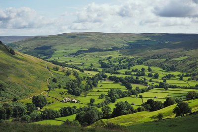
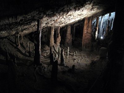
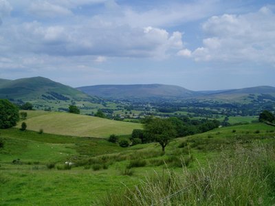
The landscape of the Dales consists of sheltered glacial valleys separated by exposed moorland. The predominant rock is Carboniferous Limestone, which is particularly visible in the south-west in features such as Malham Cove. It is overlain in many areas by the Yoredale Series of alternating weak shales and hard limestones and sandstones, which give the valleys their characteristic 'stepped' appearance. Most of the Dales contain rivers, and the area contains seven primary catchments: the Swale, Ure, Wharfe, Aire, Nidd, Ribble, and Lune. There are several notable cave systems in the area, including the longest system in the United Kingdom, the Three Counties.
Agriculture and other land management has significantly affected the appearance of the Dales, through the creation of pastures and meadows for livestock grazing and moorland for red grouse shooting. Dry stone walls and field barns are characteristic of the lower valleys, particularly Wensleydale and Swaledale in the north. Wensleydale cheese is a particularly famous product from the region. The Dales are popular for hiking, and are crossed by the Dales Way, Pennine Way, and Coast to Coast long-distance footpaths. The Yorkshire Three Peaks is a walking trail entirely within the area which takes in its three highest mountains: Ingleborough (723 m (2,372 ft)), Whernside (736 m (2,415 ft)), and Pen-y-ghent (694 m (2,277 ft)). The extensive cave systems are a major area for caving in the UK.